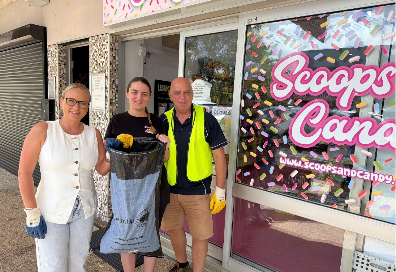
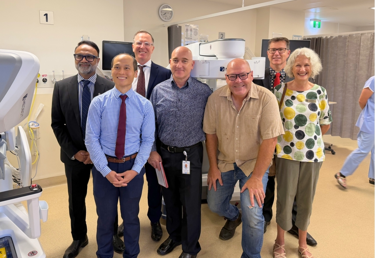
The Lismore App
The Lismore App
Your local digital newspaper
Games/PuzzlesBecome a SupporterFlood RecoveryPodcasts
The Lismore App

Local


SCU Evacuation Centre people well looked after by volunteers

06 March 2025, 7:01 PM

At yesterday's media briefing District Commander of the Richmond Police District Scott Tanner provided an update on the evacuation centres."There's currently 40 persons that are in the SCU Evac Centre. We've got another 24 that are in the Evans Head Evac Centre. We've got them opened more or less all around the district at the moment, and we're ready and prepared to take people in.There is no doubt some of those evacuated from the Lismore CBD, South, Lismore, North Lismore and the Wade Park end of East Lismore would have spent the night at the evacuation centre.When asked about what was provided or avaialble to people looking for a roof, Commander Tanner said, "There is a variety as you can understand. We're putting resources here. And the analogy we give today, don't expect a cruise ship, this is a life raft."So it's somewhere where you can go and you can be safe if you're going there expecting that you're going to get a five-star service, it's not available. We are encouraging people that before they go to an evac centre, to explore all possible opportunities with friends and families so that they're in a more comfortable environment."A shout out to the various charity providers and their staff, who were providing some necessities for those that need them.Ross and Doug from Anglicare Disaster Recovery were handing out toothbrushes and toothpaste, deodorant, soaps, ladies' items, towels, underwear and socks. They were organising books and board games to keep people entertained while they batten down in the centre.The Salvation Army Northern Rivers team were feeding people healthy ham and salad wraps.Then there was the pet section run by a state government section incase anyone has to bring their fur babies with them.If you cast your mind back three years, when the evacuation centre was set up quickly out of necessity, it is easy to see that lessons were learnt and forward planning has made such a difference to those who will be staying at the SCU evacuation centre.As Commander Tanner said, try and stay with family and friends as your first option. If you do need emergency accommodation, you will find the SCU Evacuation Centre off Rifle Range Road, East Lismore, near the health precinct.If there is flooding on Military Road, you can access the centre from Kelas Street, Lismore Heights via the Bruxner Highway or the Rotary Drive roundabout. Turn onto Kelas Street, head down the hill to the university and take a left at the stop sign. The evacuation centre will be on your right at the bottom of the hill.

SES ask parts of East, South and North Lismore to evacuate befoe 9pm

06 March 2025, 6:18 AM

The NSW SES is directing people in the following area(s) of Lismore to EVACUATE BEFORE 9:00 pm Thu 06 Mar due to forecast cyclone related major flooding: LISMORE CBDLismore CBD and surrounds, including low lying parts of Molesworth, Coleman and Brunswick Streets near the river.EAST LISMOREEast Lismore in the vicinity of Wade Park.SOUTH LISMORESouth Lismore and surrounds including all properties along Kyogle Road between Casino Street and Leycester RoadLow lying areas near Ostrom StreetParts of South Lismore to the north of Hollingsworth CreekSouth Lismore industrial areaAll properties around Casino Street and Union StreetSouth Lismore Airport and surrounding areasNORTH LISMORENorth Lismore, including Lismore showground and all properties between Cusack Road, Woodlawn Road, Winterton Parade, Pitt Lane, Bridge Street, Terania Street and Dunoon RoadSavins Road, WoodlawnSt Johns College WoodlawnPitt LaneLow lying parts of Pine StreetWinterton ParadeWoterspoon StreetWotherspoon StreetYou must evacuate before this time because forecasted heavy rain fall will close evacuation routes.Evacuation InformationYou should evacuate to stay with family, friends, or alternate accommodation in areas unaffected by flooding. If you are unable to find accommodation, Evacuation centres have been set up at Southern Cross University, entry via Rifle Range Road, East Lismore (in the Health Precinct)If you remain in the area, you may become trapped without power, water, and other essential services. It may be too dangerous for NSW SES to rescue you, and buildings may not be able to withstand the impact of flood water.What are we expecting?Based on the predictions from the Bureau of Meteorology, rainfall associated with Tropical Cyclone Alfred may cause rapid river rises and extensive flooding. Heavy and locally intense rainfall is forecast from Thursday into the weekend over Northern NSW. Flash flooding is possible. High tides and large waves are expected to increase the flood risk and impacts in low lying coastal areas.This event may change quickly. NSW SES will monitor the situation and update warnings if the situation changes.What you need to do:If you have a Home or Business Emergency Plan, follow it.Gather your possessions for evacuation. These might include mobile phone, charger, battery-powered radio, medicine, rain gear, warm clothes, blankets, baby and pet items, water, food, torch, something to attract attention, and valuables like photos and insurance or banking records.Gather your pet(s) and companion animals for safe travel.Relocate waste containers, chemicals, and poisons well above floor level.The safest option is to evacuate as early as possible to avoid additional hazards. Do not wait until the last minute.Immediately move to a safer location away from present and potential flooding. Travel to the home of family or friends who are in a safe location away from present and potential flooding.If driving conditions are dangerous, safely pull over on higher ground away from trees, drains, low-lying areas, and floodwater. Find alternative travel routes if roads or underpasses are flooded.Be aware of road hazards including mud, debris, and damaged roads or bridges.Avoid storm drains and pipes, ditches, ravines, creeks, and rivers.Never drive, walk, ride through, play or swim in floodwater - it is dangerous, toxic, and may void your car insurance. If it's flooded, forget it. Fines apply.Obey all signs about road closures and instructions from emergency services.People working or camping along the river should monitor river heights and be prepared to relocate to higher ground.All campers and caravans relocate away from the sites next to water courses

Major flooding likely tomorrow across the Northern Rivers

06 March 2025, 5:02 AM

The NSW SES has 24 'prepare to evacuate' orders for various communities in the Northern Rivers and the Mid North Coast as we head into the day with the most impact from Tropical Cyclone Alfred.Two of those were in the Ballina CBD and Fawcett Street, Kyogle as reported last night, with Coraki, Woodburn and Bungawalbin added this afternoon.In Lismore, the NSW SES says the Wilsons River is expected to exceed the minor flood level of 4.2m later this evening and may reach major flood level during Friday with forecast rainfall of 70mm to 150mm. At 3.42pm, it was 1.35m and steady.Other town centres in the Northern Rivers are on major flood watch, such as Kyogle, Casino, Coraki, Bungawalbin, Woodburn and Wiangaree. Premier Chris Minns was in Lismore for today's regular briefing. Along with Member for Lismore Janelle Saffin, "we are prepared" was the key message. That was reenforced by the fact that 2000 SES volunteers are ready to serve the community across the Northern Rivers plus the numerous high clearance vehicles, boats and air support.The Bureau of Meteorology mentioned a key variable in its recent update at midday as Alfred approaches the coast, and that is another stall just off the coast before landfall."There's more time for these rainfall totals to build and push onto the coast. And so, in terms of rainfall figures, we are still expecting to see those accumulated rainfall totals between 400 and 800mm. But higher isolated falls are possible, as you've seen, depending on how that system does move and how quickly or slowly it crosses the coast," Senior Meteorologist Jonathon How said.(A rainfall map from the BOM earlier today)Premier Minns wanted people to know the threat is not over, given the lull in weather activity, and asked everyone to do everything they can to prepare for the landfall crossing."Alfred, at the moment, is behaving a bit like a completely unwanted house guest. He has told us that it's going to be late, but linger even longer, and unfortunately, that means the window for destruction in our community, heavy rains, winds, powerful surf is longer than we would have otherwise liked."As a result of that, we're going to need the local community, we're going to be leaning on the local community, this resilient, tough, defiant community in the Northern Rivers, to do their bit. Very important that you prepare your house, particularly for loose items in the yard, on the roof, to make sure that it's not a, effectively a weapon that can fly as a result of high winds. Keep your documents together. Download the Hazards Near Me app. Never, ever drive through flood waters, put yourself in danger and an SES volunteer.""Regrettably, this town has gone through a lot in the last few years, and they know how to prepare for these natural disasters, but we're counting on them in the next few hours."Alfred stalling in the Coral Sea for 12 hours last night has given communites more time prepare. This was reiterated by Acting Superintendent Stuart Fisher from the NSW SES. He said, today will be their last day to prepare their properties. "Should they wish to stay, if they don't feel safe, then they should think about moving out, and tomorrow will be that day for that decision after that when, as I said before, when the storm hits, and particularly those high winds that will bring down trees and power lines, it may stop the egress of them coming or getting out, and for us to actually get in and to assist them."I cannot stress enough that this is a significant weather event. It is not like 2022 where we had a single event. We've had beach erosion, and which is occurring now. We'll have the very strong to dangerous and destructive winds over the next 24 to 48 hours, followed by those the torrential rain should that stall over land, we are predicting anywhere between the moment 300 to 400 mil of rain, but if it stalls, it will see an increase in the rainfall for around 600 to 700 mil of rain, which will cause, again, significant flooding on many of the river systems up and down the coast."We have currently issued over 300,000 sandbags, and there are still more to come. But again, today is the final day we believe for you to prepare your homes, and if you cannot prepare the homes, you feel unsafe to leave and leave by tomorrow."Lismore Mayor Steve Krieg said he was proud to see early preparation and felt we are so much better off now than in 2022."And that is heartening," he said, "But I want to stress to everyone that this is just the very start of what we're about to face, and so heed the warnings, critical that you heed the warnings. Don't put others in danger because you want to become an environmental tourist or take some of these selfies putting yourself in harm's way. Heed the warning, stay at home, protect your loved ones, and please stay safe. That's the most important thing. We need to get through this weather event together so that everyone is safe and well."Senator Tony Sheldon, the federal government's Special Envoy for Disaster Recovery, spoke about the Early Release Funds that was announced by the Prime Minister Anthony Albanese earlier today."To deal with the funding that's needed to make sure that we are dealing with the responses to the emergency that we're presently facing, will mean that councils and individual residents will be able to get early release of funds."It's the first time it's been done, and it's an important step in making sure that the community knows that all of us, both locally, community groups, the Premier and the Prime Minister, we are one, and we're going to be on the front foot in this event as it's arriving, and we're going to be at the front foot for the recovery afterwards."We know there'll be more work to be done after that, and we'll take those steps as necessary as the Premier and Prime Minister decide through their consultation with community."The Early Release Funds give councils reassurance that the money they spend on infrastructure repair in Alfred's aftermath will be an upfront payment rather than waiting up to two years to be reimbursed by the state government.The Prime Minister mentioned $1 million this morning, but the Premier did clarify far more is available to each council, as well as an amount for individuals that need help."It's really important that we get the message across. This is just the beginning. We know the scale of potential impacts as a result of these natural disasters. When we're prepared to walk, we want to walk the path with the Northern Rivers community, the people of Lismore in the event of the worst case scenario happening. The last three years you wouldn't wish it on your worst enemy. It's been a complete nightmare for the people of Lismore, but they are tough, incredibly resilient. They're optimistic about the future in all circumstances, and we're going to be relying on them in the days ahead."Kevin Hogan, Federal Member for Page reminded the community that this weather event is different to 2022."This is going to be different because of the wind. But I just want to repeat a couple of rainfall statistics that may happen, just so everyone can get their head around this, because we understand these 200 to 400 mils is going to be quite widespread, we get that, but we don't know exactly where yet, but there are going to be local falls in excess of 700 millimetres of rain in certain areas and certain catchments."That means the upper levels of what is expected may well happen. So, we've had time. But for anyone who hasn't, you have basically about 12 hours to further prepare. So that means, if you've lifted up, but you think you should have actually taken it physically higher, do that."If you're thinking about leaving your home because you think you may or maybe should, leave it now, because we don't know exactly where these in excess of 700 millimetre falls are going to be, but they're going to happen, and they're going to happen in certain catchments, and you have to prepare for that."So prepare for the worst, and we are all hoping and praying for the best, but you must prepare for the worst. And the worst is it's going to be as bad as we've ever seen, so you need to take precautions."When asked about the Lismore over topping, Premier Minns said, "There's not a prediction on that yet. I mean, if I'm going to be really candid about it. It's right at that level. But we've seen these storm fronts before, and I think Kevin's point is a good one, and it's well taken. There may be very intense, isolated rainfalls of up to 700 mils in particular areas. We're not sure whether it will fall directly in the Lismore catchment or not. So the best thing to do, as we've been saying for the entire week, is to prepare for the worst and hope for the best. And that's certainly what the SES has done over the last two weeks, and also Lismore council as well."Kyogle, is another town that is right in the firing line of Alfred's rage. The word is that Kyogle is likely to receive its second largest ever flood, above the 2008 level."If you look at some of the flood modeling, we're obviously concerned about it, that's why we're all here, and we've deployed resources. But I would just urge everybody to follow the Hazards Near Me app that will provide you with the latest information. That information may change, but the direction from the government and the SES will not. If you're under a prepare to evacuate order, it means exactly as it says, you should prepare for the event of evacuating, if the weather turns and it hits that community in a particular way. But until that happens, we're not going to make the call."February 28 2022 saw the SES 132 500 number and 000 fall over under the volume of calls made by people needing help and concerned family members and friends. How has this been improved in 2025?"We've put significant capacity into the emergency communications network for exactly these kinds of natural disasters. Look, I don't want to hypothecate about what could go wrong. I think we need to approach the gathering storm in a calm, methodical way, listen to the information and communication that's being communicated by the SES in particular, and if that happens and people follow the information that's being provided, I'm confident that we can weather this storm, but it's going to take all of us to do it."The Premiere mentioned that there are approximately 10,000 to 15,000 homes that are subject to a prepare to evacuate orders at the moment."That number may rise, and eventually evacuation orders may go out over a larger area. Now there's a couple of variables that the SES have already spoken about. Firstly, they want those evacuation orders to go out during daylight hours, which means they may preference it slightly earlier than they ordinarily would have, so that you're not getting an evacuation order at one o'clock in the morning like you did in 2022."So trying to learn to get best practice in place, make sure there's clear communications, but the storm path will change in the days ahead. We want to make sure the public's got up to date information."

NSW SES advise Coraki, Woodburn and Bungawalbin to prepare to evacuate

06 March 2025, 3:11 AM

The NSW SES is advising people in the following area(s) to PREPARE TO EVACUATE due to predicted moderate to major flooding: CorakiLow-lying properties along Richmond Terrace near the Club Hotel and the bowls clubWest Coraki including all properties on Kardina Street, Henderson Street, Box bridge Road, Progress Street, Dibbs Street and Purves StreetCoraki Golf Course.Doonbah and surroundsWoodburn and surrounds including all properties between River Street, Uralba Street, Langs Way and the Pacific MotorwayNorth Woodburn and surrounds including Forest Road, Bank Street and Kilgin RoadBungawalbin and surrounds including properties along Bungawalbin Whiporie Road, and Haughwood RoadYou should monitor the situation and prepare to evacuate so that you can safely evacuate when instructed to do so by NSW SES. Wherever possible, you should prepare to stay with family or friends, or make other accommodation arrangements. Evacuation InformationIf you are unable to find accommodation, Evacuation centres have been set up at Evans Head RSL, 11-13 McDonald Place, Evans Head NSW 2473If you remain in the area, you may become trapped without power, water, and other essential services. It may be too dangerous for NSW SES to rescue you.What are we expecting?Based on the predictions from the Bureau of Meteorology, rainfall associated with Tropical Cyclone Alfred may cause rapid river rises and extensive flooding along NSW coastal rivers.Heavy and locally intense rainfall is forecast from Wednesday into the weekend over Northern NSW. Flash flooding is possible. High tides and large waves are expected to increase the flood risk and impacts in low lying coastal areas.Be advised there is current Watch & Act - Stay indoors warning in place for the Northern Rivers.This event may change quickly. NSW SES will monitor the situation and update warnings if the situation changes.What you need to do:If you have a Home or Business Emergency Plan, follow it. Otherwise, have a conversation and plan for what you will do and take with you if you need to evacuate.Have your mobile phone close and pack your charger, battery-powered radio, medicine, rain gear, warm clothes, blankets, baby and pet items, water, food, torch, something to attract attention, and valuables like photos and insurance or banking records.Wear enclosed shoes and pack warm clothes for at least three days to manage unseasonably cool conditions.Check your vehicle fuel levels and towed equipment (e.g., horse floats, trailers) to ensure you can safely evacuate.Arrange to evacuate to the home of family or friends who are in a safe location away from present and potential flooding. Consider how to transport your pet(s) and companion animals.Lift important belongings up onto tables, beds, benches, and shelves above predicted flood levels.Collect or create sandbags by filling pillowcases or shopping bags with sand and place them around doorways and in toilets and over drains to prevent rising sewage.Relocate waste containers, chemicals, and poisons well above flood level.Investigate whether there are other hazards (e.g., severe storms, landslip, flash floods) that will impact your ability to evacuate.Avoid storm drains and pipes, ditches, ravines, creeks, and rivers.Never drive, walk, ride through, play or swim in floodwater - it is dangerous, toxic, and may void your car insurance. If it's flooded, forget it. Fines apply.Obey all signs about road closures and instructions from emergency services.

Tropical Cyclone Alfred update: landfall Friday night/Saturday morning

05 March 2025, 11:37 PM

The daily Tropical Cyclone Alfred update from the Bureau of Meteorology was delayed this morning to provide the latest information on its path and landfall crossing.The reason residents of Lismore and the Northern Rivers woke to calm conditions and even some blue sky was because TC Alfred stalled in the Coral Sea.The BOM's senior meteorologist Dean Narramore said Alfred has started its track towards the Queensland coast once again."Now the reason why this happened is because the high pressure system steering Alfred towards the coast, actually weakened overnight, so that allowed for Tropical Cyclone Alfred to kind of stall and remain well offshore before the high pressure system has re-strengthened this morning, and that's why we've seen a resumption of Tropical Cyclone Alfred head back towards the west, towards the south east, Queensland coast this morning."Alfred's landfall crossing is now expected to be late on Friday night or the early hours of Saturday morning. It will still be a Category 2 system."They're still going to bring these widespread impacts that we've been talking about all week, with damaging to locally destructive winds, particularly around our Bayside and coastal communities, and elevated terrain."Widespread heavy rainfall that will lead to flooding, particularly well south of where Tropical Cyclone Alfred crosses in far south east Queensland and much of north east New South Wales, and dangerous storm surge and storm tide that will lead to significant and major coastal erosion, particularly on the high tides through tonight, Friday and into Saturday. With Alfred's path slowing down overnight, there will be further impacts to the Northern Rivers."The main impacts of the system slowing down are two-fold. Firstly, we're going to have an extended and more prolonged period of significant and major wave heights leading to significant coastal erosion. Some of our offshore buoys have exceeded wave heights in excess of 10 meters, and that energy is going to continue to impact all of our beaches in north east New South Wales and far south east Queensland, leading to major coastal erosion. "The other impact of this system slowing down means we're going to have a longer and prolonged period of heavy rainfall, particularly in north east New South Wales. We've already seen widespread heavy falls through there, and that's going to continue right through Thursday, Friday and Saturday. "This means major flooding is likely for many rivers in north east New South Wales, and could even see moderate to major flooding in parts of South East Queensland as well."Dean mentioned some of the heavier falls in northern NSW were Dorrigo (west of Coffs Harbour) 237mm, Meldrum (west of Dorrigo) 235mm and Mullumbimby 168mm, and they are likely to see more heavy rainfall in the coming days.Lismore received 31.6mm at Lismore Airport to 9am today and 16mm since 9 o'clock, Terania Creek 134mm and Goonengerry 129mm.The forecast for today is for around 50mm for Lismore and 100mm for Ballina and coastal communities. Friday is still the wettest forecast day with rainfall between 70 to 150mm, and another 15 to 80mm on Saturday at this stage.The BOM still has major flooding for the Wilsons River and modertae to major flooding for most river sytems in the Northern Rivers.

Prime Minister declares Early Recovery Grants of $1 million for councils

05 March 2025, 11:09 PM

Prime Minister Anthony Albanese announced an Early Recovery Grant of $1 million for affected councils following the aftermath of Tropical Cyclone Alfred.The Prime Minister said this will help local councils with immediate road repairs without dealing with layers of bureaucracy."The money is on its way so that the work can continue absolutely immediately. We want to make sure that as soon as recovery work is physically possible, it gets underway," the PM Albanese said.The PM also said yesterday the government declared a Childcare Subsidy Period of Emergency for childcare services in South East Queensland and northern New South Wales. "That's essentially about making sure that the childcare centres are not financially disadvantaged as well as, of course, then that flow through to people.At the start of the media conference, Mr Albanese said he had spoken to Mayor Steve Krieg."He spoke about what a tough night he's had with himself and his partner. They are still in recovery mode. They've had hit after hit after hit there in that local community, but they are tough. It ended up being a discussion about how they were preparing, and how positive he was that they had put everything in place that they could at the worst of times. We always see the best of Australian character."PM Albanese explained the coordinated approach to the planning for Alfred with no borders, so working with the Premiers and key agency stakeholders in Southeast Queensland and Northern NSW.This morning's TC Alfred update has not been released by the Bureau of Meteorology, as it has on previous mornings. The Bureau of Meteorology has advised that Tropical Cyclone Alfred will now cross land later than previously forecast. It was to be about 2am Friday morning, now it is 5pm Friday evening as it's path was slowed overnight.Alfred is currently 325 kilometres east of Brisbane and 300 kilometres east of the Gold Coast moving west to southwest at 7 kilometres an hour.There were two 'prepare to evacuate' notices for the Northern Rivers last night for the Ballina CBD and Fawcett Street in Kyogle. That is also the case further north at Uki, especially for low lying properties along Kyogle Road, Meadow Place and Smiths Creek.This morning, there are more warnings to avoid coastal areas due to coastal erosion, they are Sharpes Beach at Lennox Head and Shelley Beach at East Ballina.The NSW SES is warning residents to stay indoors as Alfred approaches, even though conditions this morning have been surprisingly calm with little wind and rain.As the Prime Minister said at the start of his media conference this morning, "These are tough times, but Australians are tough people, and we're resilient people." That certainly applies to the people of Lismore and the Northern Rivers.There is another media conference with Premier of NSW Chris Minns, Minister for Emergency Service Jihad Dibb, Member for Lismore Janelle Saffin, CEO of the NSW Reconstruction Authority Mal Lanyon, SES Acting Chief Superintendent and Scott Tanner, LEOCON, NSW Police Superintendent, to provide an update on Tropical Cyclone Alfred at 11:30am.

Lismore City Council implements emergency plan

05 March 2025, 8:01 PM

Lismore City Council has implemented its emergency plan to prepare for the arrival of Tropical Cyclone Alfred.CARPARK CLOSURESAs at 5pm yesterday, council closed the following CBD carparks:Hensley CarparkKirkland Riviera / Benelong CarparkRowing Club CarparkLISMORE LEVEE FULLY OPERATIONALCouncil reassured the community that the Lismore Levee System, including pumps, gates and levees, are fully operational.All damage sustained during the 2022 disaster impacting levee integrity or pump operation has been repaired. Lismore is ready to operate the levee operational plan.RIVER GAUGES FULLY OPERATIONALAll river and rain gauges are fully operational and are reporting accurate and frequent data through to SES and BOM.Their operational capabilities will continue to be closely monitored.TRACTOR PUMP MOBILISED AND PUMP STATIONS FULLY OPERATIONALCouncil has mobilised assets in preparation for an event. A tractor has been positioned on Molesworth Street near the Lismore Transit Centre to assist with water removal should gravity drainage become ineffective.The tractor powers a pump operating at approximately 600L/s, helping to keep the CBD open for an extended period. Browns Creek Pump Station will also support efforts to maintain CBD accessibility. All Lismore water pump stations are fully operational and ready to activate if water levels rise.TEMPORARY PUMP MOBILISED – THREE CHAIN ROADCouncil has deployed a temporary pump on the earth levee at Three Chain Road, South Lismore.This pump will support water removal on Three Chain Road and Wilson Street, helping to keep these streets open for an extended period.

Red Cross helping with trauma at evacuation centres

05 March 2025, 6:36 PM

Red Cross Deputy Leader Jenny Dowell spoke about the Red Cross' role during the Tropical Cyclone Alfred weather event."Red Cross's role, predominantly in the evacuation centre at this stage will be to be offer psychological first aid. So that means, not just for the people who've prepared their house or property physically, but also to encourage people to think about preparing their mind. "That means recognising that these emotions that people are feeling at this stage are really real and warranted, but also thinking about how you can control those emotions, particularly for the sake of people around you, and I'm particularly mentioning that for parents, the children pick up on the anxiety of parents."So if parents learn and are able to speak to their children in calm ways, that can help the children cope. And talking with the children about why we're leaving, what we need to take and reassuring children that they will be safe. That's really important. "That PFA, psychological first aid, is also what we are providing in evacuation centres. So, I encourage people to go to the Red Cross website. On the front page of that website are things to do with emergency management, and managing your emotions, and preparing so we will get through this with the help of these wonderful agencies around us. "We encourage people to reach out to their neighbors, to their friends, check in, offer a place for friends to stay if those friends are in the flood zone, remember and plan for your pets, and really importantly, be as calm as you can to make the best decisions that you need to make at the time that you make them."Jenny highlighted that the work they have been doing has been ongoing since 2022."We know it's really important for our community to be prepared for any emergency. We also know that our community has a high level of anxiety because of the memory of three years ago. And we also have new people in our community who perhaps come into the flood zone, who perhaps are unaware. We have also lots of people with elderly neighbors.""Red Cross and the other agencies have been running community gatherings to build up the community's ability to support each other. It's really supporting each other, not just what will help people get through this emergency stage, but to help people in the recovery stage as well. So that's been going on continually, and many people are now more prepared, not just prepared physically, but more prepared mentally, for these things. "That's not to take away the fact that this is a really difficult situation for very many people. And emotions are high.

Changes to health services as District prepares for Tropical Cyclone Alfred

05 March 2025, 9:00 AM

Northern NSW Local Health District (NNSWLHD) will reschedule planned surgery and temporarily suspend outpatient services over the next two days as the impact of Tropical Cyclone Alfred begins to take effect across the region.Temporary changes to medical services are being made to allow NNSWLHD to prioritise the emergency medical response and provide the best possible care for patients, while ensuring the safety and welfare of staff.Planning is underway to ensure ongoing care for the community, with NNSWLHD activating its Emergency Operations Centre (EOC) and emergency management plans.All necessary steps are being taken to prepare for this major event, including potential impacts from heavy rainfall and flooding, high winds and tidal inundation of low-lying areas.  To help focus on emergency care, the following service changes will apply on Thursday, 6 March and Friday, 7 March 2025:All planned surgery and outpatient services will be postponed and rescheduled for as soon as possible. Urgent cancer treatment, including chemotherapy, will be brought forward to Thursday morning.Any postponed planned surgeries will be rescheduled. We are contacting patients to confirm further details. Community Health services will suspend outpatient appointments on Thursday and Friday.Hospital in the Home (HiTH) services, including palliative care, will temporarily stop taking referrals. Patient cases will be reviewed and strategies put in place to facilitate care while not conducting home visits over this time.BreastScreen NSW services will be closed from 5 – 9 March at Tweed Heads, Murwillumbah, Ballina and Grafton, with services at Lismore, Coffs Harbour and Port Macquarie under review.Communications have gone out to all impacted patients, community and health service providers.Wherever possible, patients have been discharged from facilities across NNSWLHD where clinically appropriate, and increased patient transport services introduced to help with transfers.Northern NSW Local Health District Chief Executive Tracey Maisey said, “We are preparing for the worst and hoping for the best.“We have made temporary changes to our services to ensure we are appropriately resourced and can focus on providing the best possible care for our community over the coming days, while providing certainty for patients and staff.“We know some staff will be affected by this weather event. We are supporting our staff to stay safe, while also ensuring we can continue to deliver health services to the Northern Rivers community.“All necessary steps are being taken to prepare for this major event, including ensuring our facilities are stocked with sufficient medication, food and linen supplies, with contingencies in place for potential power and communication outages.“We know many people may be feeling concerned about the approaching weather event and we encourage them to seek help if needed. Please check our social media pages for useful links to get help.”Helpful resources:If your life is in danger, please call Triple Zero.If you or someone you know needs specialist mental health care, please call the Mental Health Line on 1800 011 511. It is a free service operating 24 hours a day, 7 days a week and is staffed by specialist mental health professionals who offer mental health advice, and referrals to local mental health services.If you need crisis support, please call Lifeline Australia at any time on 13 11 14. Children and young people can call Kids Helpline at any time on 1800 55 1800 or chat online at kidshelpline.com.auFor non-crisis support, please call beyondblue on 1300 22 46 36. There’s also a range of online resources to support you and your loved ones. Please visit Beyondblue and Lifeline online. Young people should visit heaspace.org.au, Kids Helpline or ReachOut.comMore information on mental health services and support can be found on the NSW Health website at www.health.nsw.gov.au/mentalhealth/services/Pages/default.aspxFor free health advice anytime day or night, call Healthdirect on 1800 022 222. Need support in your language? You can call the Translating and Interpreting Service (TIS National) on 131 450 and ask for Healthdirect.

Public Information and Inquiry Centre opens for TC Alfred

05 March 2025, 8:07 AM

In response to Tropical Cyclone Alfred, the Public Information and Inquiry Centre (PIIC) has been activated to support the multi-agency response.The predicted conditions have potential to damage homes and property, as well as possibly causing trees and powerlines to fall.The Public Information and Inquiry Centre can be contacted by calling 1800 227 228.You can contact the Public Information and Inquiry Centre for information relating to severe weather and flooding anticipated when the cyclone makes landfall.It will operate on a 24-hour basis until the weather system abates.The NSW Police Force has also activated the ‘Register Find Reunite’ capability, to assist in the registration of those who have been displaced by the floods in north of the State.Police are encouraging those within the impacted flood areas to register their movements using the Australian Red Cross’ ‘Register, Find, Reunite’ service.The Register, Find, Reunite website – https://www.redcross.org.au/emergencies/about-register-find-reunite/ – is a National system managed and operated by Australian Red Cross.It is a service which registers, finds and reunites family, friends and loved ones after an Emergency. It allows people to:Register to let people know they are safe,Find people who may be affected by an emergency and know they are safe, andReunite through a matching process which enables police – with consent – to share details of family and friends with each other.State Emergency Operations Controller, Deputy Commissioner Peter Thurtell, has appealed for the public to not become complacent.“Members of the public in flood affected areas need to heed the warnings and advice of the NSW State Emergency Service and all emergency services. “Our message is clear – do not put your life or that of emergency service personnel in danger. “Floodwater is extremely dangerous as it can have fast moving undercurrents that can wash people and vehicles away. “During this weather event, avoid going outside and if you do drive, plan ahead – pay attention to RMS message boards for road closures or hazardous conditions, and never drive, ride or walk through floodwater,” Deputy Commissioner Thurtell said.For the latest on road closures, visit the website www.livetraffic.com or contact their local councils.It should be noted this inquiry hotline does not replace the State Emergency Service emergency hotline. If you are seeking emergency assistance during a flood or storm, call the NSW State Emergency Service on 132 500, or visit their website www.ses.nsw.gov.au. For all other emergencies, the public are advised to contact Triple Zero.

Prepare for Cyclone Alfred power outages

05 March 2025, 6:26 AM

Essential Energy crews are preparing for the impact of Cyclone Alfred, which is expected to cause widespread power outages due to high winds and flooding along the NSW coast from the Queensland border to the Mid North Coast.An Emergency Operations Centre has been set up at Tweed Heads, and additional crews, portable generators, fuel pods, and mobile communication systems are being brought into the area.“We are working with a range of other agencies to prepare and plan for a multi-organisational approach to the clean-up and restoration efforts if the power system in the Northern Rivers and Mid North Coast is impacted,” an Essential Energy spokesperson said.Customers are encouraged to prepare for the possibility of losing power for several days, depending on the extent of damage to the network and the location of floodwaters.Essential Energy crews will restore power as soon as it is safe to do so but cannot operate in floodwaters, lightning, or extreme weather conditions.Residents are advised to:Secure loose items around propertiesRecharge phones and laptopsHave alternative power sources for water pumps and cookingUnplug sensitive electrical equipment during stormsKeep a torch and battery-powered radio handyCreate an emergency planIf you see fallen powerlines, burnt areas, or injured livestock, stay at least 8 metres away, call Essential Energy on 13 20 80, and wait for the all-clear.For updates, visit the Essential Energy Outages page.In an emergency, always call 000.

NSW SES says Stay Indoors unless you are moving to safety but leave now

05 March 2025, 5:28 AM

The key message from the 12:30pm briefing by NSW SES and Police was to Stay Indoors and only travel if there is a necessity or if you are leaving your house to move to a safe place.Acting Chief Superintendent Stuart Fisher is the NSW State Emergency Service Operations Commander for this event said, "I cannot underestimate to the public the severity of this event that's about to encroach on us. We would suggest that if they can evacuate or to move out of the danger zones, they do so now. Our concern going forward is once the trees and power lines come down due to the strong winds, they may impede their egress out of the area. It may also impede the access for emergency services to get into those areas."There will be some who think that they can wait until the last minute to get out, and again, we're asking them to leave. Now the problem, as we all know, these people will try and drive through flooded waters that no doubt will put them at risk, will put our volunteers at risk and the other services trying to rescue them. So again, we ask if they wish to leave, they should do so now."District Commander of the Richmond Police District Scott Tanner said, "Use today as the day that you prepare for the next three days, the weather is going to deteriorate, as we've heard, and it's going to be unsafe to be on the roads."Commander Tanner said at this stage there are no evacuation orders in place. However, communities at high risk like Lismore, the CBD and North and South Lismore and Kyogle should seriously consider leaving their houses and go to family and friends or as a last resort, an evacuation centre.Acting Supt Fisher said the main concern right now is coastal erosion, dangerous four to seven metre waves followed by severe and destructive winds."Those winds will get up to around 120 kilometers per hour, and that will be then followed by torrential and heavy rain. If members of the public have not already thought about evacuating or moving to outside the danger zone, we are now asking them, if it's safe to do so, to think about enacting your plan and moving out of what you may think is the low risk or low lying areas.Acting Supt Fisher then went on to describe the resources that have moved into the area to help with Alfred's aftermath."NSW SES have substantial resources up here at the moment. We have expert and professional flood rescue crews on standby from today. We have highly trained storm crews up here from today, we have high clearance vehicles to assist in any of those flooded areas. We have what we will call 'cell on wheels' for emergency communications, and we have a number of our emergency services partners, including, NSW Police, Fire and Rescue, VRA and Surf Life Saving up here to support us as well."State headquarters has ADF (Australian Defence Force) representation down there, and they are talking with them. If we need to bring them in, they'll they'll be in that discussion.""We have at least six helicopters placed in Grafton and Casino. The problem with helicopters is they can only fly in reasonable weather. Our concern will be that, and again, members probably need to understand that they can't fly during extreme weather, so it's high winds, torrential rain, but we do have them on standby, ready to go when we can get them up."Senator Tony Sheldon, Special Envoy for Disaster Recovery for the Federal Government mentioned a S61 (Sikorsky) helicopter is also ready to do a heavy lift supply and move people to assist in what we might be facing over the next few days and beyond.As for the potential rainfall and resulting flooding, Acting Supt Fisher said we are expecting between 300 and 400mm of rain over the next three days. However, there is a serious concern."One of the concerns is if the cyclone, once it reaches landfall, it may stall. And if that's the case, that would severely increase the rainfall to around 600 to 700 mm of rain. So, we are hoping that it does what it's supposed to do."As for the million dollar question on business owners' lips in the CBD, will the Lismore levee overtop?"We have information that the levy may top. We're looking at, I'll come back with the figure for you, but we are looking at that to top. We are now putting measures in place. We have spoken to the communities down there. We have spoken to the shopkeepers, and they're preparing for that. I believe that will happen Friday to Saturday."Acting Supt Fisher said he believes both Lismore catchment area, Wilsons River to the northeast and Terania Creek to the northwest will receive rain.For those worried about sandbags, or the lack thereof, another 100,000 were on their way to the Northern Rivers today. A fresh load of sand was delivered to the sandbagging area at the Lismore Golf Club on Barham Street at about 11am today.Already, SES crews have been called to attend property damage for leaking roofs, which is expected to increase to flood rescues and substantial leaking of property and flood inundation of property in the coming days.Commander Tanner said he felt confident that this time emergency services are much better prepared."We've only got to have a drive around town and see the amount of extra resource that we've got in town. So on top of the SES, there's RFS crews that are coming to town. We have Fire and Rescue Swift Water Crews. We have over 24 Police Rescue Units that have come into town. So, I'm very confident that with the community's support, that we are in a well prepared position to make sure that everyone can get through this unscathed. I want to really reinforce, though, that this is dependent on the community and their actions, they need to make their own assessments where they are right now, and is it safe to be where you are? If not, you need to go where it is safe."Senator Sheldon concluded today's event by saying, "I just want to remind everybody to make sure you've got your emergency plan there. Make sure you're not going through floods, and also a great call out to the Northern Rivers. You are ready, I know you are determined to make sure this goes smoothly. Look after each other, and certainly keep in contact with the SES and your authorities, make sure you get the right advice, and clear advice about what next steps to take."More updates when they appear.

NSW SES evacuation centres open at 4pm today

05 March 2025, 3:01 AM

Evacuation centres across the Northern Rivers will be up and running by 4 o'clock this afternoon as emergency services continue their pre-Tropical Cyclone Alfred preparations.During today's media briefing, Acting Chief Superintendent Stuart Fisher, who is the NSW SES Operations Commander for this event, advised that the weather warning has shifted to a 'Watch and Act' for Lismore and the Northern Rivers.Supt Fisher said 'Watch and Act' is to keep yourself informed of the coming weather event and be prepared to leave.Evacuation centres were to be used as a last resort, with a preference for people to stay with family and friends."If they choose to go to an evacuation centre, we suggest they take their medicines, any valuables they might want to have, because they may be there for a little time when they do go to an evacuation centre."That is the last resort. We would encourage, if they do decide to leave their area, to go and stay with friends and family and use the evacuation centres as a last resort."Supt Fisher said he believes the evacuation centres will not have bedding."It's basic. They will have services there from support services."Scott Tanner, the District Commander for the Richmond Police District reassured the community that there is a lot of support in regards to evacuation centers."As stated before, there are a number that are being opened up and down the coast. The majority of those will open from four o'clock this afternoon. They will be in the communities of Ballina, Casino, Kyogle, Lismore and Coraki. There will also be another one at Evans Head, and we are at the moment working on establishing one in Alstonville."When we have those all locked away, that information will be put up onto the SES website so people can access that."As we've said before, evacuation centres are probably the last place that you want to go. If you do have the ability to get to family or friends or alternate accommodation, we ask that you do that now. Use today as the day that you prepare for the next three days. The weather is going to deteriorate, as we've heard, and it's going to be unsafe to be on the roads."Below are the official evacuation centres that have been established across northeast NSW:NORTHERN RIVERS - OPEN FROM 4PMLISMORESouthern Cross University: Rifle Range Road, East Lismore (the same location as the 2022 flood in the Health Precinct)BALLINASouthern Cross Public School: Chickiba Dr, East BallinaALSTONVILLEAlstonville High School: Cawley Close, AlstonvilleKYOGLEKyogle Memorial Hall: Stratheden Street, KyogleEVANS HEADEvans Head RSL: 11-13 McDonald Place, Evans HeadTYALGUMTyalgum Community Hall: Coolman Street, TyalgumCORAKICoraki Public School: 50 Adams Street, CorakiBURRINGBARBurringbar Sports Club: Fourth Avenue, BurringbarUKIUki Hall: 1642 Kyogle Road, UkiTWEED HEADS / BYRON BAY - OPEN FROM 4PMBANORA POINTBanora Point Salvation Army: The Centre Cnr Leisure and Woodlands Drive, Banora PointKINGSCLIFFKingscliff TAFE: 806 Cudgen Road, KingscliffMURWILLUMBAHMurwillumbah TAFE: 146 Murwillumbah Street, MurwillumbahMULLUMBIMBYMullumbimby RSL: 58 Dalley Street, MullumbimbyOCEAN SHORESOcean Shores County Club: 113A Orana Road, Ocean ShoresTERRANORATerranora Public School: 650 Terranora Road, TerranoraFor more information: https://www.ses.nsw.gov.au/during-an.../evacuation-centres. Locations may increase.If you require emergency help, call the NSW SES on 132 500 and if life-threatening, call 000.

All 121 public schools closed in the NRs

04 March 2025, 10:35 PM

The NSW Department of Education has closed 121 schools from the Clarence Valley north to the Queensland border, and inland to the Kyogle Shire due to potential impacts from Tropical Cyclone (TC) Alfred, including a heightened risk of flooding.They are non-operational from today, Wednesday 5 March, through to Friday 7 March 2025."We request families do not send your children to school for the next three days. Our school staff will be onsite this morning in case the message is not received in time," a spokesperson said."At this stage we expect schools to resume operations on Monday 10 March 2025."As always, the safety of our students and staff remains our highest priority."We have taken these steps to ensure we are prepared for the worst, while still hoping for the best."We know a lot of our North Coast communities have been through some difficult periods in recent years."We want to do everything we can to ensure our school communities are well supported and our staff and students are as safe as they can be."The SES has asked that families prepare their homes for strong winds, by putting away loose items around their home, trimming trees aways from properties and not parking vehicles under trees or powerlines."Never drive, walk, ride through, play or swim in flood water, and any avoid unnecessary travel.Download the Hazards Near Me App to stay across the latest warnings and information.Call the NSW SES on 132 500 if you need emergency assistance in floods and storms. In a life-threatening emergency, call Triple Zero (000).For more information, visit www.ses.nsw.gov.au.List of closed schoolsCasino Public SchoolChatsworth Island Public SchoolLeeville Public SchoolDrake Public SchoolEvans River Community SchoolGulmarrad Public SchoolHarwood Island Public SchoolIluka Public SchoolLawrence Public SchoolOld Bonalbo Public SchoolPalmers Island Public SchoolRappville Public SchoolMummulgum Public SchoolWoodburn Public SchoolStratheden Public SchoolTabulam Public SchoolYamba Public SchoolMaclean Public SchoolBonalbo Central SchoolCasino West Public SchoolMaclean High SchoolCasino High SchoolEmpire Vale Public SchoolFernleigh Public SchoolRous Public SchoolNewrybar Public SchoolWardell Public SchoolBroadwater Public SchoolByron Bay Public SchoolCabbage Tree Island Public SchoolBallina Public SchoolBangalow Public SchoolLennox Head Public SchoolSouthern Cross Public SchoolTeven-Tintenbar Public SchoolBallina Coast High SchoolByron Bay High SchoolClunes Public SchoolCoraki Public SchoolLismore Public SchoolEltham Public SchoolGoonellabah Public SchoolLismore South Public SchoolRosebank Public SchoolWollongbar Public SchoolTregeagle Public SchoolWyrallah Public SchoolWyrallah Road Public SchoolLismore Heights Public SchoolCaniaba Public SchoolAlstonville Public SchoolBexhill Public SchoolAlbert Park Public SchoolWilson Park SchoolThe Rivers Sec C Lismore High CampusThe Rivers Sec C Richmnd Riv High CampusThe Rivers Sec C Kadina High CampusAlstonville High SchoolThe Channon Public SchoolCoffee Camp Public SchoolCollins Creek Public SchoolCorndale Public SchoolDunoon Public SchoolEureka Public SchoolJiggi Public SchoolKyogle Public SchoolLarnook Public SchoolManifold Public SchoolThe Risk Public SchoolWhian Whian Public SchoolModanville Public SchoolNimbin Central SchoolUrbenville Public SchoolWiangaree Public SchoolWoodenbong Central SchoolAfterlee Public SchoolBlakebrook Public SchoolBarkers Vale Public SchoolSouthern Cross School of Distance EdDorroughby Environmental Ed CentreKyogle High SchoolCondong Public SchoolCudgen Public SchoolDungay Public SchoolDuranbah Public SchoolFingal Head Public SchoolTumbulgum Public SchoolTweed Heads Public SchoolTerranora Public SchoolPottsville Beach Public SchoolKingscliff Public SchoolBanora Point Public SchoolBilambil Public SchoolTweed Heads South Public SchoolCentaur Public SchoolBogangar Public SchoolCaldera SchoolBanora Point High SchoolTweed River High SchoolMullumbimby High SchoolChillingham Public SchoolCoorabell Public SchoolCrabbes Creek Public SchoolCrystal Creek Public SchoolGoonengerry Public SchoolThe Pocket Public SchoolMullumbimby Public SchoolMurwillumbah Public SchoolTyalgum Public SchoolUki Public SchoolWilsons Creek Public SchoolStokers Siding Public SchoolMain Arm Upper Public SchoolUpper Coopers Creek Public SchoolBrunswick Heads Public SchoolBurringbar Public SchoolOcean Shores Public SchoolMurwillumbah East Public SchoolMurwillumbah High SchoolKingscliff High SchoolWollumbin High School

41-60 of 2681
The Lismore App
The Lismore App
Your local digital newspaper


Get it on the Apple StoreGet it on the Google Play Store