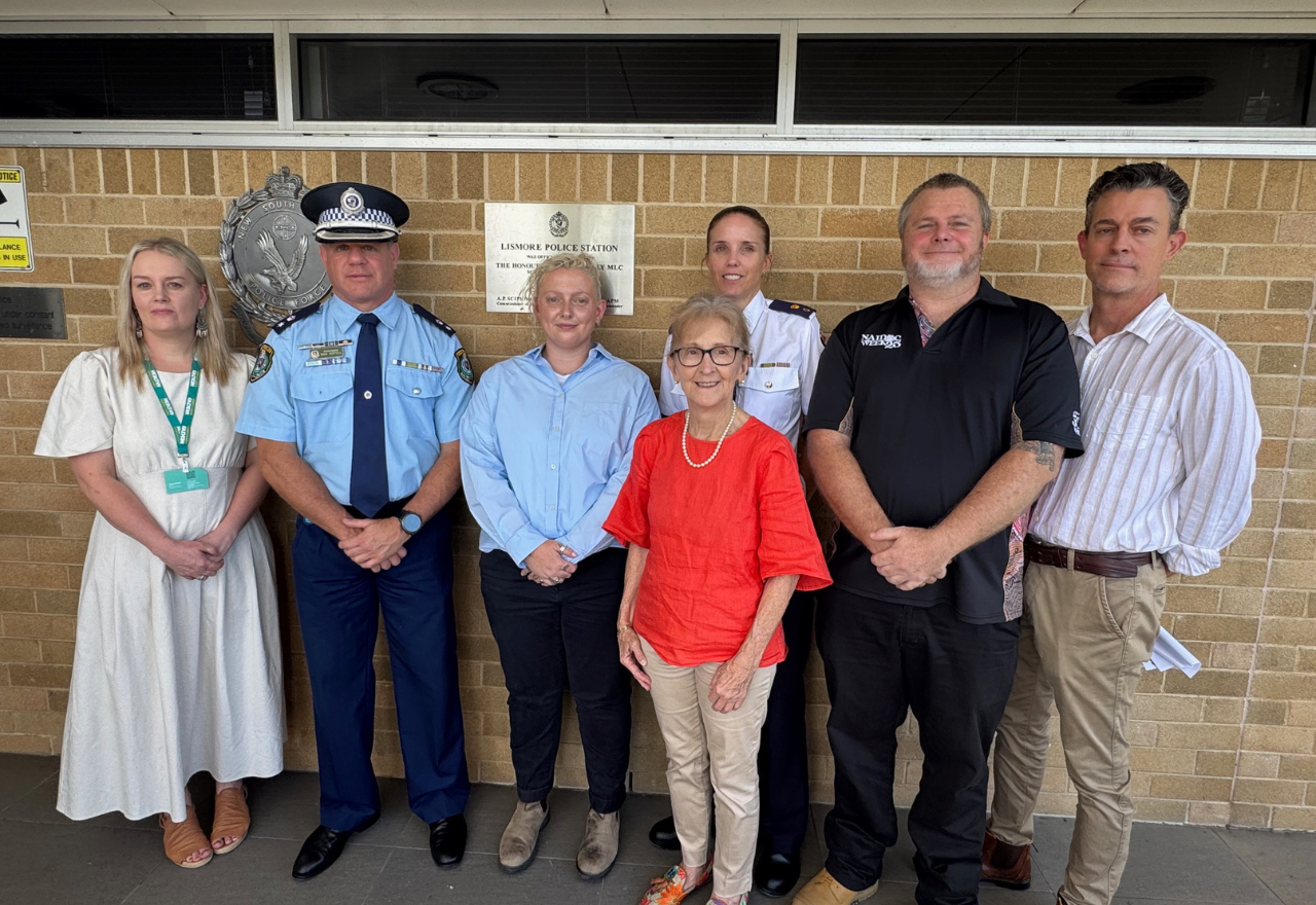
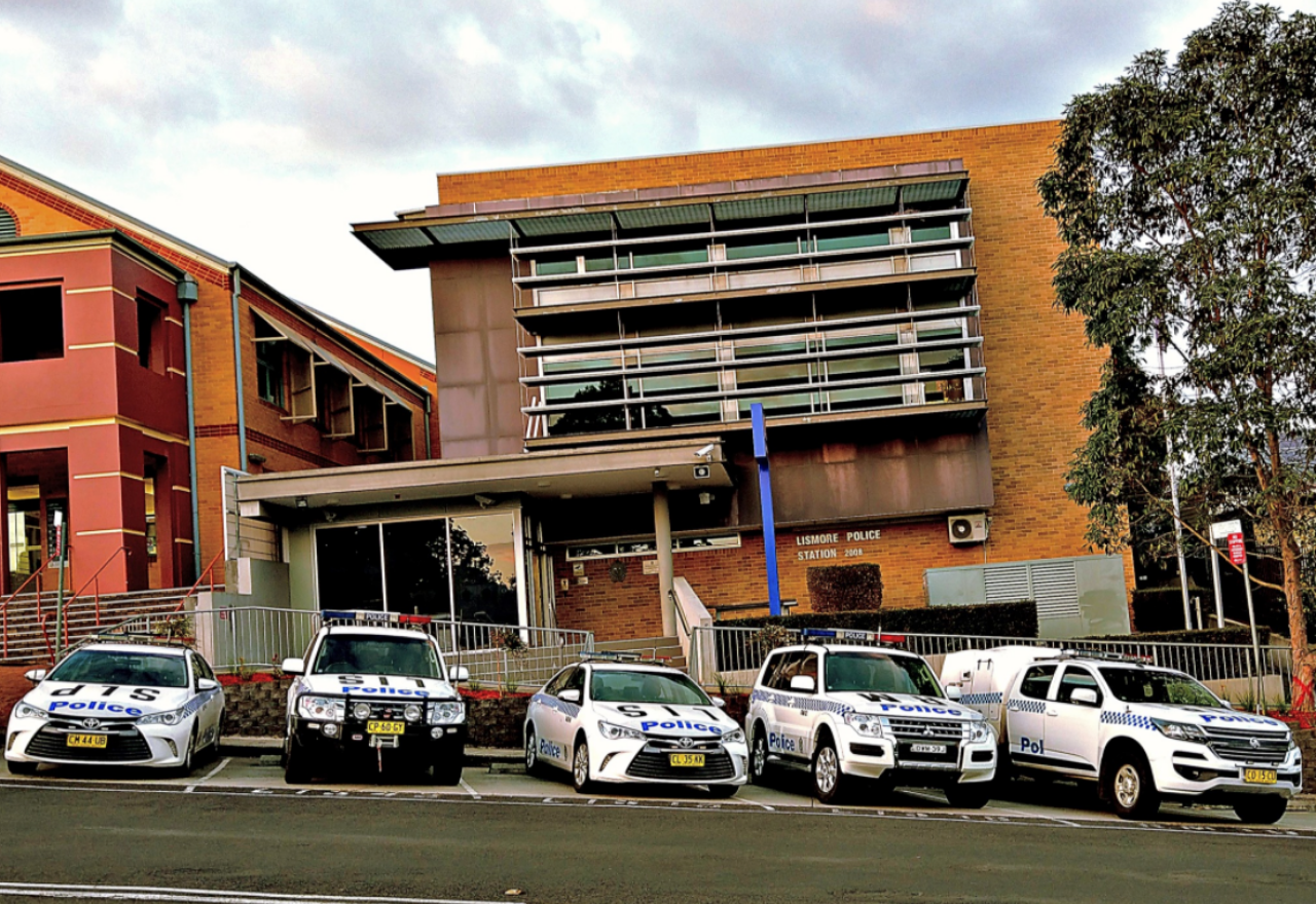
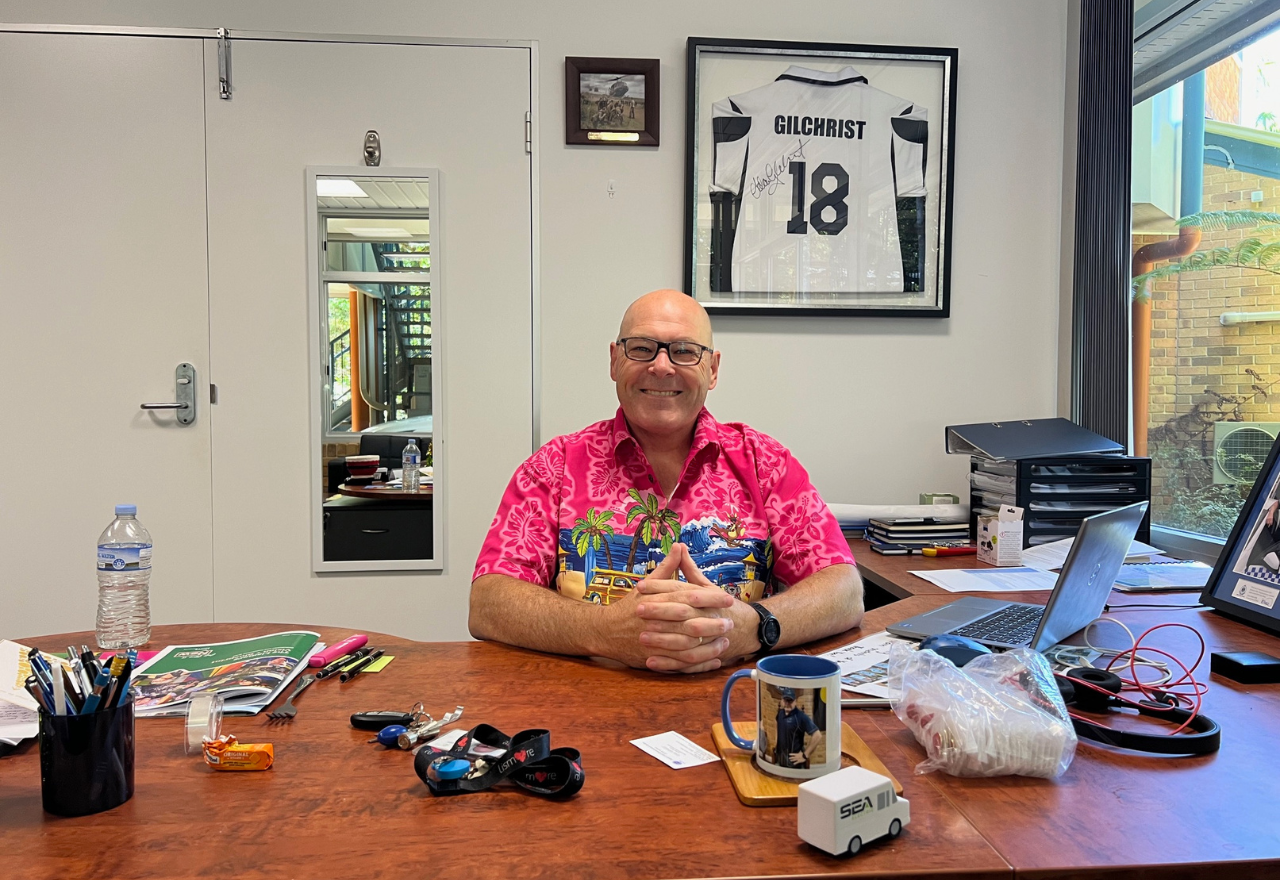
The Lismore App
The Lismore App
Your local digital newspaper
Games/PuzzlesBecome a SupporterFlood RecoveryPodcasts
The Lismore App

Local


Tropical Cyclone Alfred update: Brisbane crossing early Friday

04 March 2025, 9:11 PM

There have been no surprises with Tropical Cyclone Alfred's path in the last 24 hours. The landfall crossing is slightly further south, with the Bureau of Meteorology saying Brisbane is the likely location with the crossing likely at 2am on Friday morning, give an hour or two either side. As was stated yesterday, significant impacts are expected over large areas away from the landfall point, especially on the southern side of the cyclone, so Northern NSW.Christie Johnson, a senior meteorologist at the Bureau of Meteorology said Alfred is still a Category 2 system that is currently 500km east of Brisbane, over the Coral Sea.There are a number of warnings in place for Lismore and Northern NSW."A tropical cyclone warning is current for communities from the Queensland border south to just north of Grafton. "A severe weather warning has also been issued for the Northern Rivers area, as well as parts of the mid north coast and the northern table lands due to the expected heavy to intense rainfall and damaging to destructive winds. So that heavy rainfall is expected to start to develop on Thursday, with intense rain coming late Thursday night or early Friday morning, which may lead to life threatening flash flooding, especially around the east-facing slopes of the Northern Rivers and the northern Tablelands. "Damaging winds are expected to develop today, but destructive winds with gusts up to possibly around 150 kilometers an hour more are possible in areas north of Grafton, late on Thursday and early on Friday."A coastal hazard warning stretches from the Queensland border all the way down to the mid north coast, around Forster for abnormally high tides and damaging surf, and a hazardous surf warning extends down to the Illawarra today and will extend to the Eden coast on Thursday. So this means dangerous conditions on the foreshore and out on the water, and it does mean dangerous conditions for activities such as swimming, boating and fishing. "There's also marine wind warnings with a storm force wind warning for the Byron coast, gale warnings for the Macquarie coast and a strong wind warning for the Hunter coast. "Flooding is also possible from later today, as rain increases and a flood watch is current for the Northern Rivers and mid north coast areas with widespread moderate to major flooding. Moderate to major flooding may develop from Thursday in the Flood Watch area, and we're also expecting possible flash flooding, and also high tides and large waves are expected to increase the flood risk and the impact in low lying coastal areas."Christie said that our Wednesday outlook is to expect winds to increase along the coastal fringe and then extend inland as the day progresses. "Within the tropical cyclone warning area, we also will start to see showers and isolated thunderstorms on and near the coast becoming heavier at times later today, and large waves and hazardous coastal conditions will continue as we move into tomorrow, Thursday, we will see the damaging to destructive winds developing as the tropical cyclone approaches. "These are sustained winds that can cause significant damage to property and vegetation. We'll also see that heavy to intense rainfall developing and isolated thunderstorms. So we'll likely to see flash flooding, and then as totals build, riverine flooding developing as well. And of course, those large waves and hazardous coastal conditions that will continue once the tropical cyclone makes landfall. "Following landfall, the danger isn't over. We will continue to see heavy rain and significant winds persisting and extending inland and down the New South Wales coast, and of course, flooding impacts will continue over the weekend and into early next week."Lismore has recorded 11.4mm to 9am on Tuesday and 9.6mm to 8am today (Wednesday) at Lismore Airport. The forecast is still for 35mm to 140mm on Thursday, 35 to 150mm on Friday and 25 to 100mm on Saturday before an easing on Sunday 2 to 30mm.You can stay up to date with the latest weather information from The Bureau via the Lismore App Weather or directly through their website http://www.bom.gov.au/index.php. There will be another report later today following the 12:30pm media briefing at NSW SES Northern Rivers Headquarters in Goonellabah.

Don't forget the batteries

04 March 2025, 8:01 PM

With Lismore and the Northern Rivers on cyclone watch, residents are being urged to check and charge their batteries, as an important part of their preparation.Supermarkets have been inundated with people looking to stock up with food supplies, and Battery World Lismore owner, Greg Woolley, says batteries are a critical, but often overlooked, part of any emergency kit.“There’s no point having a torch, if there’s no way of powering it up,” he said. “Just about everyone has a battery drawer at home, but the contents can be random or out of date.“Taking the time to plan really could save your life and the lives of your family. Our advice is to be prepared and make sure your emergency preparedness kits are checked annually.”Top tips for making sure your batteries are ready for TC Alfred:Check what size your torch/radio/appliances takeEnsure you have adequate supply of all sizesCheck the expiry dates on your existing batteries, to ensure they haven’t lost chargeCharge all your portable devices before the storm hitsObtain and charge a power bank, so you can keep your mobile running if power remains out for a period.“Batteries are often something people forget about until they need them, but they can be a lifesaver during natural disasters,” said Battery World’s General Manager, Johnny Kennedy.“Having enough spare batteries for three days is recommended along with portable battery-operated AM/FM radiowith spare batteries (AA/AAA) and waterproof torches with extra batteries.“If you find yourself sheltering in your home without power, you’ll need to keep up with all local updates. Having a means of lighting and some charging capability is also imperative,” he added.EMERGENCY KIT SUPPLIESPowered Items:Torch (battery or wind-up)Portable phone charger and cableBattery powered radioExtra batteriesSolar powered generator Food & water itemsFood & Water Items:Water for three days (10 litres per person)Non-perishable food for three daysCan opener, cutlery & plates Medical & personal items:First aid kitMedications and prescriptionsWarm protective clothing and shoesSturdy glovesToiletries (for example toilet paper, sanitiser, face masks, toothpaste, soap, baby nappies) Important documentsImportant Documents:Emergency phone numbersPassports and identificationCashInsurance papers and property deedsBirth and marriage certificatesPhotographs and keepsakesStore your important documents in sealed plastic bags or keep a digital copy on a USB or secure online storage.Pet supplies:Food and waterToysBeddingMedication

Additional emergency crews deployed ahead of Tropical Cyclone Alfred

04 March 2025, 7:00 PM

As was mentioned at yesterday's media briefing at SES Headquarters in Goonellabah, deployments of additional crews from the NSW State Emergency Service (SES) have begun arriving in Lismore and the Northern Rivers and the Mid North Coast as the NSW Government ramps up preparations for the potential impact of Tropical Cyclone Alfred.The NSW SES is leading the response and working with other emergency services and government agencies to get ready for the cyclone, which is expected to cross the Queensland coast Thursday night or Friday morning.The NSW SES will be able to draw from thousands of volunteers with support from flood rescue trained emergency service personnel across NSW Rural Fire Service, Fire and Rescue NSW, Surf Life Saving NSW, and Marine Rescue NSW. All are equipped with flood response and wider capabilities.Residents should prepare for damaging winds, large surf, and heavy rainfall, with impacts of the cyclone forecast to be felt from as early as today. Low lying areas may be at risk of coastal erosion.From today (Wednesday) onwards, predictions are for intense rain, which could lead to moderate and major flooding in many areas, with the potential to close roads, inundate properties and lead to evacuations.The NSW SES State Command Centre has been stood up in preparation for the severe weather. As well as additional personnel, the NSW SES is prepositioning communication equipment, aviation resources and specialised vehicles ahead of the forecasted impacts of the cyclone. The deployment to date includes two helicopters, two ‘Cells on Wheels’ (emergency service communication hubs), two high clearance vehicles, and a Wi-Fi connectivity trailer, along with back-up generators to support telecommunications towers.NSW SES, in partnership with local councils, have established numerous sandbag stations across the impact footprint to assist communities to defend their properties. Residents requiring advice on sandbag stations can check NSW SES social media pages or contact 132 500. More than 1,500 calls for information and preparedness advice have been received by the NSW SES so far.NSW SES is facilitating community meetings in towns across the impacted areas to ensure residents are aware of the risks, forecasts and how to prepare.We would encourage communities to prepare, but there’s no need to panic buy. Supermarkets have good supply chains and transport links are currently open. If your community becomes isolated and needs resupply of essential goods, NSW SES and other emergency services agencies will assist with this.Local communities are urged to monitor weather conditions and ensure they have a plan for their family and pets if asked to evacuate. Resident should also prepare for possible power outages, in the case of damage to infrastructure such as trees falling onto power lines.Residents should download the ‘Hazards Near Me’ App which will include the latest warnings and information for impacted communities.  People are also encouraged to prepare an emergency kit with essential items including identification documents, medications, a torch, mobile phone charger and a battery-operated radio. For assistance during floods and storms call the NSW SES on 132 500 or Triple Zero (000) for life threatening emergencies. All emergency service agencies are ready to support affected communities.People who require mental health support can also call the Mental Health Line on 1800 011 511. It is a free service operating 24 hours a day, 7 days a week and is staffed by specialist mental health professionals who offer mental health advice, and referrals to local mental health services.Minister for Emergency Services Jihad Dib said, “The NSW Government is supporting the NSW State Emergency Service as they do all they can to prepare ahead of Tropical Cyclone Alfred crossing the coast later this week.“Now is the time for residents in the affected areas to get ready for damaging winds, large powerful surf, coastal erosion, and intense and heavy rainfall.“We are asking the community to take steps now to ensure that if you are asked to evacuate your home you have a plan for this and know where you will go.“Please download the Hazards Near Me App which will include the latest warnings and information for impacted communities.”Minister for the North Coast Rose Jackson said, “Keeping people safe is our top priority. Emergency teams are mobilised and a comprehensive whole-of-government plan is underway.“Now is the time to get ready—have an evacuation plan, stay informed and follow SES advice. Download the Hazards Near Me app for local updates and check in on your neighbours.“The Northern Rivers community is strong and resilient, but we know this weather event is causing a real concern. We assure the community - emergency services are on the ground and ready to help.”Parliamentary Secretary for Disaster Recovery Janelle Saffin said, “I continue to receive regular briefings and updates from the SES, police and other combat agencies, and the message I’m giving to people here on the Northern Rivers and Mid North Coast is to listen to their advice and be prepared for what is a rare, unpredictable weather event for our region.“All forecasting points to us experiencing a lot of strong winds and heavy rainfall as Tropical Cyclone Alfred heads towards the coast and crosses land.“Our emergency services are putting more personnel and resources in place. The community can help them by securing their properties or businesses in a practical sense, and wherever possible, stay at home and not take to the roads, waiting for the danger period to pass, then keep an eye on river levels afterwards.”    Commissioner of the NSW State Emergency Services Mike Wassing said, “This has the potential to be a serious weather event. Over the coming days, we expect to see strong winds continue, followed by intense and heavy rainfall.“NSW SES crews and emergency service partners are prepositioned across the region to respond to incidents as they arise.  “Assets including communication equipment, high clearance vehicles, aircraft, and support personnel have been prepositioned across Northern NSW. “NSW SES is facilitating community meetings in towns across the impacted areas to ensure residents are aware of the risks, forecasts and how to prepare.”

Bureau issues severe weather warning for Lismore and NRs

04 March 2025, 9:50 AM

The Bureau of Meteorology has issued a Severe Weather Warning for HEAVY, LOCALLY INTENSE RAINFALL and DAMAGING, LOCALLY DESTRUCTIVE WINDS for Lismore and the Northern Rivers.As forecast, Tropical Cyclone Alfred has started to move west towards the southeast Queensland coast this afternoon. This motion will continue through Wednesday with the system expected to make landfall along the Southeast Queensland Coast on Thursday night or Friday morning between Brisbane and the Sunshine Coast. Heavy rainfall and damaging winds will extend well to the south of the centre of the system over parts of the Northern Rivers, Northern Tablelands and Mid North Coast.HEAVY RAINFALL which may lead to FLASH FLOODING is forecast to develop about parts of the Mid North Coast, Northern Rivers and Northern Tablelands during Thursday. Six-hourly rainfall totals between 60 and 110 mm and 24-hour totals between 100 and 200 mm are likely. Locally INTENSE RAINFALL which may lead to DANGEROUS AND LIFE-THREATENING FLASH FLOODING may develop during Thursday evening and continue into Friday. Six-hour rainfall totals between 200 and 250 mm and 24-hour totals between 300 and 400 mm are possible, particularly around the eastern-facing slopes in the Northern Rivers and Northern Tablelands. These figures are dependent on the movement and position of the system.DAMAGING WINDS averaging 60 to 65 km/h with peak gusts to 120 km/h are likely to develop over northeastern New South Wales north of Grafton during Wednesday, and continue throughout Thursday and Friday. DESTRUCTIVE WIND GUSTS up to 150 km/h may develop north of Grafton late Thursday or early Friday.A Tropical Cyclone Advice and Forecast Track Map is current for Tropical Cyclone Alfred.A Coastal Hazard Warning and Hazardous Surf Warning is current.A Flood Watch is current for northeast New South Wales.For these products, please refer to: http://www.bom.gov.au/australia/warnings/Locations which may be affected include Lismore, Grafton, Coffs Harbour, Byron Bay, Ballina, Casino, Kyogle, Yamba, Maclean, Woolgoolga, Sawtell and Dorrigo.The State Emergency Service advises that people should:Move vehicles under cover or away from trees.Secure or put away loose items around your house, yard and balcony.Keep at least 8 metres away from fallen power lines or objects that may be energised, such as fences.Trees that have been damaged by fire are likely to be more unstable and more likely to fall.Report fallen power lines to either Ausgrid (131 388), Endeavour Energy (131 003), Essential Energy (132 080) or Evoenergy (131 093) as shown on your power bill.Don't drive, ride or walk through flood water.Keep clear of creeks and storm drains.If you are trapped by flash flooding, seek refuge in the highest available place and ring 000 if you need rescue.Be aware that run-off from rainfall in fire affected areas may behave differently and be more rapid. It may also contain debris such as ash, soil, trees and rocks.After bushfires, heavy rain and the loss of foliage can make the ground soft and heavy, leading to a greater chance of landslides.Stay vigilant and monitor conditions. Note that the landscape may have changed following bushfires.For emergency help in floods and storms, ring your local SES Unit on 132 500.The next Severe Weather Warning will be issued by 9:00 pm AEDT Tuesday.

NSW SES and combat agencies are ready for what Alfred delivers

04 March 2025, 5:23 AM

At the 12:30pm daily media briefing at NSW SES Northern Rivers Headquarters in Goonellabah today, Joanna Jones, New South Wales SES Incident Controller (IC) for the weather event associated with Tropical Cyclone Alfred said it is still difficult to predict where it will cross the mainland and difficult to predict what will happen."In the Northern Rivers, we are expecting moderate to major flooding, strong winds, extremely high and dangerous surf and the normal debris associated with storm damage."The flooding that we may experience might be flash flooding, which happens very quickly and can be extremely dangerous. There might be little to no warning of flash flooding. Riverine flooding takes a little bit longer, and is associated with heavy rainfall over a prolonged period."IC Jones asked the community for help by taking some responsibility to keep informed and act when you are asked to do so by emergency services. She then went through the warning systems."A number of warnings have already been issued. These are currently advice level warnings. They are asking the community to prepare for the impacts of this weather system."If we see an escalation in impacts, an escalation in rain, those strong winds affect northern New South Wales, the community might see those warnings escalate to orange, which says that they have to do certain things in order to stay safe."Then there is the emergency alert, the red triangle. The red triangle is very serious. It says something has to be done now. Please educate yourself about the warning systems. Please keep in contact with what's happening through news and SES media, and the Hazards Near Me app."IC Jones cyclone tracking changes every six hours, and that is when they are updated.CBD businesses were busy packing up their shops today, preparing for the chance the levee wall is topped over the weekend, understanding the 130km/h cyclonic winds will make it unsafe to do so from Thursday onwards. Car yards and truck centres were moving stock to higher ground.Some sandbagging locations ran out of sand yesterday; however, IC Jones said the SES has ordered 50,000 sandbags, so they will be replaced on a regular basis.As far as SES and Emergency Services preparation is concerned, it is stepping up a gear."We have been preparing for this event for a number of days. As a result, the resources, both physical resources and personnel, are moving into the area. We're using every emergency service agency that we have at our disposal. All our emergency service partners are involved. All the councils are involved. All levels of government are assisting.Scott Tanner, District Commander for the Richmond Police District and the local Emergency Operation Controller, added to the support personnel."New South Wales Police are here to support the combat agency, being the SES. We're providing logistical support in the form of extra rescue operators that are being deployed from the western area of the state and also from the metropolitan area. We also have our aviation command bringing assets up into this area. As of tomorrow, we'll have a fully functioning Emergency Operations Centre, and that will be there to assist the SES."The thing about the Northern Rivers is that the community are well aware of the risks. We've been through this many times. So what we are asking, is that community members put their game face on, understand what their risks are. If they've got a plan to leave the area, they do so early and as the SES said, when the weather impact does happen, to stay off the roads."If you don't need to be on the road, don't. If you can avoid travel at this stage, I would suggest to delay it until this weather event has passed.Commander Tanner was an integral part of the Lismore and Northern Rivers rescue and recovery during the 2022 floods from the Emergency Operations Centre at SCU. He believes lessons have been learnt."I think we are well versed as emergency services organisations. We learnt a lot from the 2022 flood. We put a number of systems, a number of processes in place that we believe that we are in the best position going forward to get through this event. However, it does come back down to the community."The community has to listen to the advice. You know, you reflect back on 2022 when we had the first flood event. And the second flood event a month later, we still had people driving in flood water. We can't let that happen. You need to take care of yourself and your family.(Shadow Minister for Emergency Management Perin Davey, Scott Tanner, Kevin Hogan, Janelle Saffin, SES Superintendent Scott McLennan and IC Joanna Jones talking about TC Alfred)State Member for Lismore Janelle Saffin and Federal Member for Page Kevin Hogan were also present at today's media briefing in support of the SES and our combat agencies."They've done a fantastic job in preparation. We were all here in 2022, we know what happened and what didn't happen, and I can assure the community that they're well prepared. The best thing we can do to keep ourselves, our loved ones, our neighbors, safe, is listen to the advice coming out from the SES in particular, and also prepare early. If we prepare for the worst, and we pray for the best. I just want everybody to be as prepared as they can be.Ms Saffin had some advice for the panic buying at supermarkets."I've been in the supermarkets, I've seen the shelves, and some of them are empty. I'm saying to people, just take enough. I always say, follow the 72 hour rule. That's a good rule. They use it in New Zealand, 72 hours. Make sure we've got enough for that 72 hours, and you'll have plenty, and there'll be plenty on the shelves for others, and also with fuel."Kevin Hogan wanted to remind the community of two things, "We know floods. So look, follow the warnings when they're given and leave early. You have your flood plans. You know where you are with metre predictions, leave your business or make your business safe early. And if you need to leave your residence, do it early, because the other element of this that we're not used to are going to be the cyclonic winds."It's going to get very wet, but also it's going to get very, very windy, and it's going to be extremely unsafe for everyone to be on the road network at that time, if not because of the water, but this time because of the winds and the damage that will be getting done. So it's going to be very unsafe for you. It's very unsafe for first responders to be out there to rescue people. So whatever you do, listen to the warnings and do it early."When the inevitable question came about the government moving quickly to offer support if Alfred does cause large community damage, Ms Saffin said she is having those conversations now."I'm just making sure that we're ready, and I put forward requests like, obviously, if we do get hit, of course, they'll want a natural disaster declaration, and we'll want that ASAP. So I'm involved in those conversations early."We may need other resources, depending on what happens if it crosses land. I know about the sandbags. I know what everybody's doing. I've asked how many boats are ready? We've got people operating them. So, in my role, I'm just doing everything I can because I say, better prepared, better recovery.Ms Saffin did say the NSWRA (Reconstruction Authority) is operating parallel to the combat agencies and are looking at what may be needed by the Northern Rivers community, including emergency accommodation."They're working together, preparing together, looking at what we might need, and instead of waiting till after the event, having that ready so they can ask. They're also organising the pod villages. Of course, we've still got people in our pod villages, so they've got organisation in place with the people there and getting them ready. They've got accommodation booked. I know Homes (Homes NSW) are doing that. There are evacuation centres being set up with DCJ (Department of Community and Justice)It was clarified that in Lismore, the evacuation centre will be at Southern Cross University as it was in 2022. Others are being organised today and set up tomorrow.One of the biggest complaints following the 2022 floods was the lack of communication. Ms Saffin did say the interagency communication was very strong and there is now a public information unit set up."We have to communicate well, all agencies, and I'll continue to drive that to make sure that people get the information they need. But for now, it's the SES, it's the police, it's our combat agencies, and they do a fantastic job at communication."As for advice to the community on how to get the best information, Commander Scott Tanner said, "We need the community to keep informed, and they need to take the information from the combat agencies, not from your friend down the street or someone on Facebook. It's got to be from people that are actually doing the business."The information can be read through the Bureau of Meteorology (via the Lismore App for ease of use Weather), or the BOM directly http://www.bom.gov.au/, the NSW SES https://www.ses.nsw.gov.au or download the Hazards Near Me app.

Closures and postponements/cancellations roll in for Alfred

04 March 2025, 12:36 AM

With the weather conditions worsening significantly tomorrow, event cancellations/postponements and council building closures are happening quickly.EVENTSThe Lismore City Bowling Club has postponed the final week of its 'All In The Same Boat' barefoot bowls challenge. A new date will be set in due course.The Northern Rivers Hotel has cancelled its live entertainment for this weekend.The Lismore Women's Festival on this Saturday, part of International Women's Day, has been cancelled.All events scheduled for the Lismore City Seniors Festival have been postponed.LISMORE CITY COUNCILFor the safety staff, council has suspended kerbside waste collection from tomorrow (Wednesday, 5 March) to Friday, 7 March. Lismore City Council will close Tuntable Creek Road between Rose Road and Beardow Road from 12 noon tomorrow (Wednesday, 5 March 2025) until further notice.All Lismore City Council facilities and waste service closed today.The Lismore Library on Magellan. Lismore Memorial Baths.Lismore Regional Gallery.The Lismore Recycling & Recovery Centre and Revolve Shop. Nimbin Transfer Station.The Lismore Rainforest Botanic Gardens will be closed from today due to high winds associated with Tropical Cyclone Alfred. The entrance to the gardens will be closed to all traffic, and Council’s VMS board will be updated.It is hoped to reopen on Monday, 10 March, depending on conditions.All events in The Quad have been postponed until further notice.If you want to let the community know about a postponed or cancelled event email simon@lismoreapp.com.au.

Tropical Cyclone Alfred update: potential rainfall increases

03 March 2025, 9:12 PM

As the coastal crossing of Tropical Cyclone Alfred becomes clearer, the potential rainfall for Lismore and the Northern Rivers increases.Jonathon How, Meteorologist with the Bureau of Meteorology said Alfred is likely to make landfall somewhere between Brisbane and the Sunshine Coast late Thursday or early Friday."We are expecting to see the most significant impacts, on the southern flank of the cyclone. So that does include places like Brisbane, the Gold Coast and also the Northern Rivers."In terms of numbers, Lismore is now looking at ranges of rainfall of 15-70mm tomorrow (Wednesday), 15-100mm Thursday, 20-130mm Friday and 20-110mm on Saturday.The rainfall is forecast to decrease on Sunday.There is a Tropical Cyclone Watch for the Northern Rivers."We can expect to see gale force winds developing within the next 24 to 48 hours. In addition to this, we also do have a flood watch, and that covers large parts of South East Queensland and also North East New South Wales," Jonathon How said this morning."So, with the rainfall we're expecting and fairly wet catchments and wet soils, we can expect to see widespread, moderate to major flooding, particularly for New South Wales, but also South East Queensland. This includes quite a few major rivers through major population centers with rainfall totals expected to exceed 200 to 400 millimeters across a wider area from later this week, as tropical cyclone Alfred makes landfall, there are also a number of coastal hazard warnings current."They extend all the way from Gary Fraser Island and down towards the northern parts of New South Wales. So we do have marine wind warnings for strong to gale force winds. They'll increase the storm force winds for some parts of the coastline from tomorrow. In addition to that, we still do have those very powerful easterly waves coming through, combining with high tides, and that's causing quite significant and severe coastal erosion and causing a lot of those beaches to be eaten away.Alfred is currently moving slowly in a south-to-southeast direction about six kilometres per hour, and is expected to slow even further and then make its turn west, back towards the Queensland coast later today."Into Wednesday, that's when we'll start to see the areas of rain and wind becoming more widespread and more severe. So on Wednesday, we are expecting to see a significant increase in rain, particularly heavy rainfall, and those very strong to damaging winds developing about coastal areas, and then into Thursday, that's when we'll start to see Tropical Cyclone Alfred move even closer to the coast. Rain will increase. It will see heavy to intense rainfall, as well as flash flooding and the possibility of riverine flooding developing later on Thursday."As the system gets even closer, damaging to destructive winds may cause damage to property and trees. And importantly, these damaging to destructive winds will be sustained over quite a long period of time, and so that will mean that we could see quite significant damage to properties and also trees, and then into Friday, as it does make landfall, we can expect to see quite widespread and dangerous flash flooding developed, in addition to those very strong winds moving on to the coast."Overall, for today, we are expecting to see those coastal hazards continue, rainy showers along the coast, as well as those large waves. And then for Wednesday, we'll continue. We'll see a significant ramping up in rain and winds really peaking on Thursday to Friday as tropical cyclone Alfred makes landfall."You can stay up to date through the Bureau of Meteorology through the Lismore App Weather, Weather Radar or download the Hards Near Me app.The NSW SES will have a further update at 12:30pm today.

Lismore CBD businesses enacting flood plans

03 March 2025, 7:00 PM

The Tropical Cyclone Alfred picture should become clearer this afternoon and into the early hours of Wednesday morning as it does its u-turn and starts to head towards the Queensland coast as a Category 2 system.The Bureau of Meteorology has issued a Tropical Cyclone Watch extending down to Grafton. Gale force winds will start to develop from Wednesday evening.The likely crossing is either late Thursday night or in the early hours of Friday morning as a Category 2 or potentially a Category 1 system.The Bureau's Sarah Scully said the effects will be widespread, "So not just near the actual crossing point. In fact, the greatest impacts were expected on the southern flank of the cyclone, and those impacts would include damaging to destructive winds. So, these are winds that are strong enough to bring down trees, power lines, cause damage to property, major power outages, and as well, heavy to intense rainfall that may lead to life-threatening flash flooding.""But as well, the tropical cyclones likely to create a very large storm surge, which increases the risk of coastal inundation and does make it difficult for the water to escape from the river systems."Once it crosses the coast, Alfred is expected to be quickly downgraded to a tropical low. However, the effects may be felt into the weekend. Saturday's rainfall forecast has increased to 20-70mm.Lismore business owners are closely monitoring the situation as they enact their flood plans and make preparations for what is to come.Lismore Floor Coverings is on the low end of Woodlark Street, near the Dawson Street roundabout, where it floods often, through storm water or flooding.Chantelle said they have started their plan and are moving pallets of products and rolls of carpet to a shed in Goonellabah.Next door, Sue from Floret is already pushing the go button."We get 1500mm in store before the levee is topped, so our flood plan is ready to go. We have a Pantec truck coming down from Queensland on Wednesday and we are packing now."Sue said people laughed at her when she started packing early in 2022. She has a mezzanine level to store her stock, but says her motto is "Go out not up".Dave and Sharon Martin, owners of Instyle Sleep Centre, said their philosophy is "whatever you don't need, take it away. We watch and wait."Over at Daley's Homewares & Monogramming, Matt Healy said he was "alert but not alarmed"."I am watching the situation very, very closely, but I am not worried. We will not be taking any action until we hear something more concrete. We'll make a call tomorrow afternoon, what we do."Business Lismore Secretary and Scoops and Candy owner Felicity Hyde said Shoppe One is packing up and Curious Craft Ale is packing their back area up."People are just getting prepared, which is good," Felicity said, "Many are changing their ordering for this week. 'Being aware and being prepared' si how I would describe the situation currently."The bigger retailers like Bi-Rite Home Appliances and Furniture Court are enacting the first part of their flood plan.Elton Cummings said, "We are watching it, but I don't think we'll know anything until tomorrow afternoon. I am hoping the pumps will be operating. I am concerned, not worried.""We have done our pre-flood prep. Our bulk storage items like mattresses and lounges are up in Goonellabah. We have topped up the generator with fuel and cleaned up all the old fridges and pallets that could possibly break glass.One aspect of this upcoming flood is that Lismore businesses are so much better prepared than 2022. The flood plans have been written, and now they are being put to the test.

NSW SES say a potential moderate flood for Lismore

03 March 2025, 5:32 AM

The NSW SES is saying the Wilsons River may reach a moderate flood level for Lismore given the latest information from the Bureau of Meteorology.As local anxiety rises with Tropical Cyclone Alfred due to change direction tomorrow towards the west, Superintendent Scott McLennan's words will bring a level of comfort to the majority of Lismore and Northern Rivers residents and businesses."As we've all been watching, Tropical Cyclone Alfred has been slowly making his way southward along the Queensland coast, and is now expected to come across the coast sometime later this week. Tropical Cyclone Alfred is bringing with him significant wind gusts. It's a Category 2 at the moment that has wind speeds of 89 kilometers to 100 kilometers per hour, with some gusts up to 125 kilometers an hour."We're going to see some of those impacts from those wind gusts, including coastal erosion along the coast from today and tomorrow being Tuesday, and that will actually start to increase as the week progresses. All of our river catchments have now been included in the Flood Watch."That Flood Watch is really a preparation tool that the Bureau uses to ensure that all of our visitors, our farmers and all of the residents and businesses have four days or more to ensure that they are prepared. Some of those catchments include the Tweed, the Wilsons, the Richmond, the Clarence, the Orarra, the Brunswick and Marshalls and the Coffs Coast."The advice today is that some of those catchments will achieve moderate flooding at some point this week. We are expecting significant rainfall to start from Wednesday, with daily totals of in excess of 100 mm right across the region. Some of those daily totals could actually achieve 300 mm, and that could be on Thursday, Friday or Saturday."This rain event, and this wind event is an event that is not common for northern New South Wales. However, in saying that we are prepared. We are conducting a range of different activities right throughout today, tomorrow and Wednesday, to ensure that we are prepared, and you are prepared."Take the time today and tomorrow to ensure that you have enough medicines, that you don't need to travel on Wednesday, Thursday and Friday, and that you are prepared to move if we ask you to. Clear out your gutters, clear out your drains, make sure all your loose items in and around your properties are nice and tied down and secured so they don't become missiles."And then look at your medication list and run through what your evacuation plan is. Have a chat with friends and family. Check on your neighbours, see if they're okay. It's a time that we can come together, and the best way to deal with anxiety is being able to control what you can control, and that's what you do. So take the time now to prepare."For readers living near the coast, Supt McLennan spoke about coastal erosion from waves that will be 3 and 7 metres high."Ballina won't necessarily flood, but there will be significant storm surge issues with some of those drains. We are actually working with The Bureau to ensure that we understand where those locations are, and we're actually working to prepare them."For Lismore, the forecast is that we may see a moderate flood depending on when the rain starts falling. The word from Supt McLennan for Lismore residents and businesses was clear, "Everyone in Lismore understands what their triggers are, and we are actually asking people to realise what their triggers are for themselves, so they can make those decisions early."With the amount of rain to be dumped on Lismore from Wednesday, flash flooding will be an issue."Flash flooding is going to be a major issue with this particular event. We're now asking people just to be mindful of where those flash flood areas are and do not, please do not drive through flood water, even if you have been through there before. Don't drive through it again."In terms of why we have such a wide range of potential rainfall, Supt McLenna said, "Tropical cyclones pick up more water the slower they are, and Alfred has been moving particularly slowly. So the more the slower he moves towards the coast, the more rain he's going to bring with him. If he moves faster, it'll actually be better, because it won't bring as much rain, but we just have to wait and see. We're preparing for the worst and hoping for the best."Sandbags, sand and shovels are available in these locations now:Lismore Workers Golf Club, Barham Street, East LismoreNesbitt Street Park, Casino Street, South LismoreThere are other sites in Ballina, Yamba, Casino, Kyogle and Woodburn.MULLUMBIMBY: Mullumbimby Unit - 33 Coolamon Scenic Drive (for residents of Mullumbimby and Byron)OCEAN SHORES: Soccer Field Carpark (Shara Blvd) for residents of Ocean Shores, New Brighton and South Golden BeachCASINO: NSW SES Unit - Corner Neville Bienke Memorial Drive and East Street, CasinoWOODBURN: NSW SES Woodburn Unit– 3 Uralba St, WoodburnCORAKI: NSW SES Coraki Unit – 18 Adams Street, Corner of Richmond Terrace & Adams (near the bridge)BALLINA: Council Depot – Tamarind Drive (opposite Ballina Fair shopping centre)GRAFTON: NSW SES Grafton City Unit – Irene Street, Grafton, NSW 2460For those with mobility or transport limitations, please call 132 500 for assistance. Drive carefully in the sandbag location and be patient if there is a queue.You are asked to take your own shovel, and depending on the location, they may have volunteers to help fill the sandbags. However, there will be some locations where you will have to fill your own sandbags.Communication and miscommunication have been an issue with previous floods, especially as people speculate what will happen on various social media pages. That appears to be one area that has changed since 2022."For today and moving forward for us, we are working very closely with all of our political stakeholders. We are working very closely with council. We are working very closely with community. There will be a community meeting held online, and that will be streamed live tonight as well.For those who wish to join tonight's community meeting, it will be held at at 6pm tonight (3/3/25). Use this link here: https://ow.ly/ypnw50V95wE."We will do press conferences every single day at 1230 this week to ensure that you remain informed as quickly as what we do. When the situation changes, we will be out in front with you, helping lead the way and leading the response. We are working very closely with all of our emergency service partners, whether that be Fire and Rescue, New South Wales Police or any of the other partners, including Ambulance New South Wales, to ensure that you remain safe."Please heed the warnings when they come. Listen to the advice and please don't leave it to the last minute. If we ask you to evacuate, please evacuate. If you need assistance, always call us on 132 500."We've got this Northern Rivers. We've done it before, and we can do it again. Stay informed with Hazards Near Me, or visit us at www.scs.nsw.gov.au if you need any assistance, including preparedness advice, call us on 132, 500.

Council launches Live Flood Ready campaign

03 March 2025, 12:05 AM

Following feedback from the community, Lismore City Council has launched a new flood preparedness campaign – Live Flood Ready – to raise awareness in households, on how to prepare for one of Lismore’s most recognised natural hazards.Council has partnered with the lead emergency service, the NSW SES, to bring together up-to-date information and tips on how to prepare for a flood in one easy-to-access location so households can make informed decisions about their flood risk.Lismore Mayor Steve Krieg said the approach of tropical Cyclone Alfred was a reminder that is important that we do not become complacent.“Those who have lived in Lismore all their lives understand the reality is Lismore is built on a floodplain, and we will flood again,” he said.“It is up to each one of us to ensure that we are prepared, we have a plan, and we are ready to act if we need to. We all have a role to play and should not solely rely on SES volunteers in a severe weather event.”The four-week campaign, which will encourage the community to go to the updated flood information section of Council’s website, will include jargon-free flood terminology, tips and tools to Live Flood Ready, available apps to download, and links to the NSW SES and other useful websites and social media pages to follow and stay informed.Simply go to the ‘natural hazards’ section on Council’s website at www.lismore.nsw.gov.au and hit the Floods icon.In addition to this education campaign, Council will also work closely with the NSW Reconstruction Authority and NSW SES on a regional program later this year to increase community flood-risk awareness. The Australian Government will fund this work through the Northern Rivers Recovery and Resilience Program (NRRRP). Did you know Council’s role during a local flood emergency is to:Serve as a conduit for key information on the emergency event from the State Emergency Service and police.Support the NSW SES, the lead agency in an emergency, with the resources, people and equipment they need to manage the emergency and any follow-up recovery actions.Continue our constant and close monitoring of Council-managed open spaces, reserves, facilities, telemetry, levee system and roads for any impactsMobilise our own resources, people and equipment to respond to any identified impacts.Provide key information to the community and relevant stakeholders about how Council’s services or facilities are impacted such as Water and Sewer Services, Waste Collection and availability of Council Services.Support community led approaches to coping with emergencies. Council works closely with the Local Emergency Management Committee (LEMC) to ensure that all aspects of Emergency Prevention, Preparedness, Response, and Recovery are well supported and resourced.

Cyclone Alfred update: continues to move southeast

02 March 2025, 9:11 PM

As forecast by the Bureau of Meteorology, Tropical Cyclone Alfred was downgraded to a category one system on Sunday, but as of Monday morning, it has strengthened back to a Category 2 system. John How from The Bureau said they are seeing winds near the centre of 95 km/h and wind gusts up to 130 km/h."As of Monday morning, it is currently a category two system over the Coral Sea, about 465 kilometers northeast of Brisbane and 410 kilometers northeast of Maroochydore on the Sunshine Coast. It is moving in a south-easterly direction at around 13 kilometers an hour, sort of about a running pace, moving down towards the south-east."As we know, there are a number of warnings for both South East Queensland and North East New South Wales already in place."So first, we do have marine wind warnings all the way from K'gari down through the Sunshine Coast off Brisbane, the Gold Coast and the Northern Rivers of New South Wales. That's for strong to gale force winds, and we'll see those strong winds extending down to even the mid north coast of New South Wales over the next few days. "There is also a coastal hazard warning for parts of the Queensland coast. That is for very powerful waves, which you have been seeing over the weekend, as well as normally high tides. And the combination of very powerful waves and these high tides does mean that we are already seeing beach erosion across southern parts of Queensland. Those high tide peaks will gradually start to recede from today, but those strong waves coming in from the east will persist for several days as Tropical Cyclone Alfred sits off the coast of Queensland. "Other warnings. We do also have a hazardous surf warning for parts of the south east, Queensland coast and North East New South Wales. That does mean that if you are heading out to the water, this will be dangerous for activities like swimming, boating and also rock fishing. In addition to this, the Bureau has also issued an initial flood watch for both Queensland and New South Wales. "For Queensland, it does include quite a few catchments across the south east of the state, this is a heads up for heavy rainfall, increasing from late Wednesday, continuing into Thursday and Friday. Catchments across South East Queensland are dry to moderately wet, and as well as that normally high tide coming through, it does increase the risk of flooding for those coastal low lying areas, but once the rainfall does pick up, we could see widespread, minor to major flooding across the Queensland FLOOD WATCH area from late Tuesday, late Wednesday and also into Thursday, but the location of the highest rainfall will determine where we do see that flooding. "We also have an initial flood watch for the Northern Rivers and also the mid north coast. This is also for the potential of up to major riverine flooding as you start to see that rainfall coming through late Wednesday into Thursday, and also Friday. So across both these areas, we are reminding residents to keep across the latest warnings and also flood watches as well, and later on Monday, we are expected to issue the first tropical cyclone watch that's for the onset of gales across mainland areas likely to be on onset from sort of Wednesday and into Thursday as well. So quite a few warnings, and we are expecting more warnings to be issued over the coming days."Jonathon said Alfred is expected to continue to move towards the southeast today and may be downgraded to a Category 1 but then is still expected to move back towards the west towards southeast Queensland coast as a Category 2 system.The forecast path of Tropical Cyclone Alfred, shown above, is the Bureau's best estimate of the cyclone's future movement and intensity. There is always some uncertainty associated with tropical cyclone forecasting and the grey zone indicates the range of likely tracks of the cyclone centre.You can stay up to date with the Bureau's weather updates via the Lismore App Weather or through the website https://reg.bom.gov.au/nsw/forecasts/lismore.shtml.

CANCELLED! Celebrate International Women's Day at the Lismore Women's Festival 

02 March 2025, 8:00 PM

UPDATE: 2:50pm Monday March 3This event has been cancelled due to the weatherThis Saturday, March 8, is International Women's Day. To celebrate, the Northern Rivers Women and Children's Services Inc. (NORWACS) is putting on the Lismore Women's Festival, a vibrant and inclusive event celebrating women at the Quad in Lismore from 9am to 4pm. Organisers say this year's festival promises a day filled with enriching activities and performances. Attendees can look forward to a variety of workshops hosted in the Art Gallery, the Con, and the Library.  The Festival will also feature food and market stalls, providing a delightful array of local products and culinary treats.  The day will commence with a Welcome to Country by Aunty Queenie Speeding, setting a respectful and inclusive tone for the day’s celebration. The festival will be hosted by the dynamic Mistress of Ceremony, Lissie Turner, and will feature a keynote address by the acclaimed journalist and author Jess Hill. The festivities will conclude with an all-inclusive participatory Flash Bang Mob choir, where Eve Jeffery from Byron Bay Singing will be inviting everyone to join in a joyful and harmonious celebration. A NORWACS spokesperson said, "We are proud to host the Lismore Women’s Festival for the fifth consecutive year. With Lissie Turner as the MC and keynote speaker Jess Hill, we anticipate this year’s festival to be the biggest yet! Join us on Saturday, March 8th, at the Quad and surrounding Arts Precinct for a jam-packed program. Everyone is welcome!NORWACS invites everyone to join in this celebration of women's achievements and contributions. The Lismore Women's Festival is a free event open to all members of the community. Find all the details here: https://norwacs.org.au/lismore-womens-festival/.

Kevin Hogan talks about the campaign to reopen Wollumbin/Mt Warning

02 March 2025, 7:02 PM

Federal Member for Page and Shadow Minister for Trade and Tourism Kevin Hogan joined the Talking Lismore podcast last week to discuss some of the hot topics in Lismore and the Northern Rivers. They included the campaign to reopen Wollumbin/Mt Warning, US tariffs and his thoughts on the three years since the 28 February 2022 big flood.Mr Hogan wouldn't be drawn into predicting a date for the 2025 Federal Election; however, he did say there is a chance of an early April election if the Prime Minister calls it soon after the W.A. State Election, or in May. We do know that it must happen on or before Saturday, May 17. This is looking the most likely election option."Obviously it's a pre-election period. When you go into the campaign proper, there's a whole lot of rules that change around what you can and can't do. We live in a wonderful democracy. I know some people might get sort of like, oh, here we go, but look, there's billions, and I say billions of people on this planet that don't get the freedom to vote in an election and have a choice. At least they might vote in an election, but there's only one choice in some countries. So look, we live in a wonderful democracy, and it's a really important part of our democracy."To win 19 seats to win government is a tall ask for the Liberal/National Party. Is he optimistic?"Look, I'm a politician and a part-time farmer, I'm always optimistic. I think, look, it's going to be close, I think it's going to be really close. There's only been one government in the history of Australia, since Federation, so we're 124 years now into our federated system, and only once has a government been one term, and that was the Great Depression. So, it's a big ask to win from opposition in one term, but look, I think it's on. I think it's a real possibility. Labor's primary vote, from what I can see, has gone under 30%, which makes it very difficult for them. They certainly won't be a majority government. If they win, they'll be going into a minority government with The Greens and the Teals. I think that's problematic, if that happens."Our primary seems to be going back through 40, and if we start climbing through 40, I think we're a real chance to win."What about being confident about the seat of Page, which is now considered a safe seat."I am never confident, but optimistic. You know, I've been fortunate enough to be re-elected four times by our community, and I never take it for granted, and I'm always very grateful for that. So, I'm putting myself up to go again. And the public in this beautiful democracy have the right to tell you whether you're doing a good job or not."Last week there were calls for the Wollumbin/Mt Warning walk to be reopened, with local tourism operators and Indigenous elders joining forces to advocate for its accessibility.Mr Hogan visited the mountain with Bundjalung elder Sturt Boyd, emphasised the importance of reopening the track for cultural and economic reasons. He highlighted the potential of the site to attract and educate tourists about First Nation's culture and the importance of the site and generate millions of dollars for the region, stating that up to 100,000 people could walk the track annually."We went up there with Sturt Boyd. Sturt's grandmother, Marlene, was the guardian of that mountain. So, he's an elder. I've seen some very disturbing reports from media outlets saying he's an alleged elder. I've never heard that before, but he didn't suit certain people's narratives. He is an elder. He wants it reopened. The Wollumbin Consulting Group that has been formed, he thinks, is not transparent, is not representative. So he has issues with that," Hogan said."They want to ensure the mountain is accessible to everyone, not just a select few."Mr Hogan acknowledged there are differing viewpoints within the Indigenous community, as well as the broader community. He stressed the importance of respecting those who hold opposing views. He cited the significant public support for reopening the track, noting that over 90% of the 70,000 to 80,000 people reached through his social media platforms expressed their desire for its accessibility.Mr Hogan intends to advocate for the reopening with the relevant state minister, alongside Sturt Boyd and Kimberly Hone, the Nationals candidate for Richmond.When it came to the potential US tariffs on our mining industry products, Kevin Hogan expressed concerns and drew parallels to the previous Trump administration's trade policies, noting that Australia was able to secure an exemption from tariffs on certain products during that period."We were in government then. We had Ambassador Hockey at the time. It was very important to open doors for us and to get meetings with Trump, and we were able to get an exclusion. So Australia was excluded from the tariffs in Trump, Mark 1," Hogan said.Mr Hogan emphasised the importance of the government engaging with the US to secure an exemption, as they did previously."I am concerned about Rudd's effectiveness. He's made some very derogatory comments about Trump. So is he going to be as effective as Joe Hockey? I don't know, and it's disappointing," Hogan said.The Member for Page also criticised the handling of the flood mitigation efforts in Lismore, three years after the devastating floods. He described the decision by the Northern Rivers Reconstruction Corporation (NRRC) to withdraw from the floodplain as a "failure," arguing that it has not provided adequate protection for residents."Withdrawing from the flood plain has failed because of the 2000 homes that were identified, at best, we're going to have probably 800 or 900 and of those 800 or 900, some you'd know personally, like I do, some of them have sold their house on the flood plain through the buyback program, and bought a house around the corner on the flood plain," Hogan said.Mr Hogan mentioned the CSIRO's upcoming report on flood mitigation and suggested that engineering solutions are necessary to effectively address the flood risk. He acknowledged the potential controversy surrounding such proposals with a small percentage of the population but emphasised the need to prioritise safety and enable residents to live securely in their homes and for people to invest in the Lismore CBD.You can listen to the full Talking Lismore podcast via the Lismore App or by clicking here for the website link https://talkinglismore.buzzsprout.com/.

Bureau issues initial Flood Watch for Northern Rivers

02 March 2025, 5:02 AM

The Bureau of Meteorology has issued an initial Flood Watch for rivers within the Northern Rivers in anticipation of the rainfall from Tropical Cyclone Alfred.The Bureau says, "Rainfall associated with Tropical Cyclone Alfred has the potential to cause major flooding along NSW coastal rivers from the Queensland Border to Port Macquarie, with the locations and severity of flooding dependent on the track of the Tropical Cyclone. Flooding may develop from late Wednesday, and continue until at least the weekend."Tropical Cyclone Alfred is currently located off the Queensland Coast and is forecast to move southwards parallel to the coast before tracking westward on Tuesday. This will bring heavy and locally intense rainfall from late Wednesday over the South East of Queensland, and the Northern Rivers and Mid North Coast of New South Wales, and continuing on Thursday, Friday and into the weekend. The heaviest rainfall will be south of the Tropical Cyclone track."Coastal catchments in the flood watch area are relatively wet. Abnormally high tides are expected to increase the flood risk in coastal low lying areas. High sea levels and large waves are likely at coastal locations, and may exacerbate flooding and cause flooding impacts."Moderate to major flooding may develop across the flood watch area from late Wednesday into Thursday. The location of the most severe flooding will depend on the location of the heaviest rainfall, and the areas at risk will continue to be revised during the coming days."Rapid river levels rises and flash flooding is expected across many creeks, associated with the heaviest rainfall with widespread, including major, riverine flooding possible. Flood Classes (minor, moderate, major) are only defined for catchments where the Bureau provides a flood warning service."For the latest flood and weather warnings see www.bom.gov.au/nsw/warnings/For the latest rainfall and weather forecasts see www.bom.gov.au/australia/meteye/For the latest rainfall and river level information see www.bom.gov.au/nsw/floodFlood Safety Advice:This Flood Watch means that people living or working along rivers and streams must monitor the latest weather forecasts and warnings and be ready to move to higher ground should flooding develop.Flood Warnings will be issued if Minor Flood Level is expected to be exceeded at key sites along the main rivers for which the Bureau of Meteorology provides a flood warning service.Severe Weather Warnings will be issued or updated if very heavy rain is forecast or observed.For more information on the Flood Watch Service: http://www.bom.gov.au/water/floods/floodWarningServices.shtmlFloodSafe advice is available at www.ses.nsw.gov.auFor emergency assistance call the SES on telephone number 132 500.For life threatening emergencies, call 000 immediately.

Tropical Cyclone Alfred update: expected to turn towards coast Tuesday

02 March 2025, 3:00 AM

Tropical Cyclone Alfred is taking the path forecast by the Bureau of Meteorology as it moves south parallel to the Queensland coast and away from the coastline.At 11am this morning, Alfred was a Category 2 system 515 kilometres east of Rockhampton and 370 kilometres northeast of Bundaberg moving at 10 kilometres per hour.Alfred has been weakening as it heads south and tonight it is forecast to turn southeast and move further away from the Queensland coast while weakening a little further. Unfortunately, Alfred is then expected to slow down and is likely to turn westward from Tuesday, moving back towards the southern Queensland coast. The forecast path shown above is the Bureau's best estimate of the cyclone's future movement and intensity. There is always some uncertainty associated with tropical cyclone forecasting and the grey zone indicates the range of likely tracks of the cyclone centre.There is hope that the system may take a different path on Tuesday.As you would expect at this early stage of Alfred's path, the rainfall range from The Bureau is wide.The best case scenario at the moment is for 22mm over the four days (Tuesday to Friday), while the worst case scenario is 195mm over the four days.You can keep up to date with Cyclone Alfred through the Lismore App Weather or through this Lismore App website link https://reg.bom.gov.au/nsw/forecasts/lismore.shtml.(Issued at 11:53 am AEDT Sunday 2 March 2025 by the Bureau of Meteorology. No Tropical Cyclone Advice is current for this system.)

SCU's Dr Alana Gall awarded $640,000 to research First People's cultural medicines

01 March 2025, 8:22 PM

Southern Cross University researcher Dr Alana Gall has been awarded an Investigator Grant of more than $640,000 to lead a research program focused on First Peoples' Cultural Medicines (also called bush medicine) in Australian healthcare.The latest round of the prestigious National Health and Medical Research Council’s (NHMRC) Investigator Grants scheme, funded by the Federal government, is worth $422 million.Dr Gall’s project spans two key areas. The first is embedding Cultural Medicines into Australian health policies to improve cultural safety, health and wellbeing. The second is to protect Cultural Medicine knowledge through research that informs research and development in drug discovery, regulation and intellectual property, to realise the self-determination of First Peoples and their communities.“Despite initiatives, including Closing the Gap, disparities persist in health outcomes for First Nations peoples. We need to focus on community-driven solutions that align with First Peoples’ ways of knowing, being and doing,” said Dr Gall.“This encompasses plant medicines, native foods, healing ceremonies, spiritual medicine, Traditional Healers, and both the tangible and intangible healing aspects of Country.”With the boom in recent years of products based on native Australian plants and traditional knowledge, Cultural Medicines face the double dilemma of misleadingly being regulated as a food or appropriated for commercial profit with minimal or no benefits returned to the community.“We need to make sure Cultural Medicines are appropriately regulated for the health and safety of all Australians and that First Nations Intellectual Property is protected from biopiracy,” said Dr Gall.Dr Gall’s project has the backing of three major partners: the National Aboriginal Community Controlled Health Organisation (NACCHO), the Commonwealth Scientific and Industrial Research Organisation (CSIRO) and the Australian Nuclear Science and Technology Organisation (ANSTO).About the Investigator Grant SchemeThe Investigator Grant is NHMRC’s largest funding scheme and plays a critical role in supporting the Australian health and medical research sector by providing a salary (if required) and a significant research support package.It’s the third time in the history of the scheme that women researchers will receive more funding overall.NHMRC CEO Professor Steve Wesselingh congratulated all researchers who were successful in the 2025 funding round.“NHMRC funds investigator-led research where Australia’s highest performing health and medical researchers set out to achieve ambitious goals of improving the health and wellbeing of the Australian community,” he said.

Regional Gallery new exhibition OCCURENT AFFAIR

28 February 2025, 8:48 PM

Lismore Regional Gallery is pleased to present OCCURRENT AFFAIR - a major exhibition featuring new and recent works by influential Aboriginal artist collective proppaNOW.Established in 2003, proppaNOW is one of Australia’s leading cultural collectives – members Vernon Ah Kee, Tony Albert, Richard Bell, Megan Cope, Jennifer Herd, Gordon Hookey and Laurie Nilsen explore the politics of Aboriginal art and culture, re-thinking what it means to be a ‘contemporary Aboriginal artist’.Conceived as a collaborative activist gesture, OCCURRENT AFFAIR addresses current socio-political, economic and environmental issues, while celebrating the strength, resilience and continuity of Aboriginal culture. Engaging wordplay through its title, OCCURRENT AFFAIRreferences the sensational journalistic style of some television current affair programs. OCCURRENT AFFAIR embraces the slippage between language and its associated readings to probe and present new narratives. The exhibition will reflect on the ongoing state of affairs affecting Aboriginal communities – issues that are relevant to all Australians.One of Australia’s leading Indigenous arts collectives, proppaNOW was set up in Brisbane in 2003 to give urban-based Aboriginal artists a voice. They present a unique and controversial perspective of black Australia, which is sometimes confronting and always thought provoking. proppaNOW create art that raises awareness of Aboriginal urban expression that depicts a contemporary story. They reinforce that Aboriginal Australia is a living culture that has evolved over time and dispel the notion that Indigenous art needs to be from a remote area to be ‘authentic’.This will be proppaNOW’s last exhibition as a collective – seeing this historically significant movement at Lismore Regional Gallery is an unmissable opportunity. Ashleigh Ralph, Director at Lismore Regional Gallery, says of the exhibition, "It is with great pleasure that we can showcase some of Australia’s preeminent contemporary artists at Lismore Regional Gallery. OCCURRENT AFFAIR is engaging and thought-provoking, providing a platform for important conversations around socio-political and cultural issues. "Our public programs offer the community meaningful engagement with these themes. Bringing this exhibition to Lismore reinforces the legacy of Lismore Regional Gallery as the cornerstone of cultural life in the Northern Rivers and a gallery that attracts national and international audiences."As part of OCCURRENT AFFAIR, there are a range of public programs. Visit the website for the latest information.OCCURRENT AFFAIR soft openingSunday 2 March, 12 - 1pmFollowed by Gathering Space with Kylie Caldwell for Aboriginal artists and community membersEmbassy programming in the Quad1 March – 27 AprilA platform for First Nations people to have a voice and share stories, poetry, and ideas.Words as activism: placard making workshop with artist Penny EvansSaturday 5 April, 10am – 12pmUsing Richard Bell’s Embassy as inspiration, artist Penny Evans facilitates a placard painting workshop for all ages, exploring the power of words.OCCURRENT AFFAIR closing celebrationSunday 26 April, 1 – 3pmJoin Rhoda Roberts OA in conversation with proppaNOW artists.

61-80 of 2682
The Lismore App
The Lismore App
Your local digital newspaper


Get it on the Apple StoreGet it on the Google Play Store