Wilsons River rises as Richmond River has minor flood warning

Simon Mumford
28 March 2025, 7:11 AM
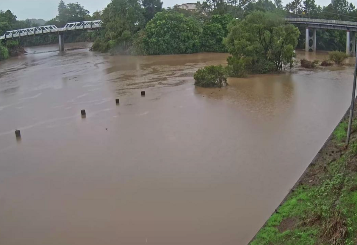 The bottom car park at Bi-Rite Home Applicances completely closed just before 3pm. Photo: Elton Cummings
The Wilsons River continues to rise as rain continues to fall, not only in Lismore but also in the upper catchments.
At 6pm, the Wilsons River level was 3.41m and is expected to reach the minor flood level of 4.2m later tonight. The Bureau of Meteorology said it may reach 4.5m Friday night into early Saturday morning.
Moderate to heavy rainfall is forecast across the Flood Watch area for the remainder of Friday through to Saturday, with locally heavy rainfall possible. There is some degree of uncertainty over the exact location and timing of the heaviest falls. Localised river level rises, and flash flooding are likely within the areas of heaviest rainfall.
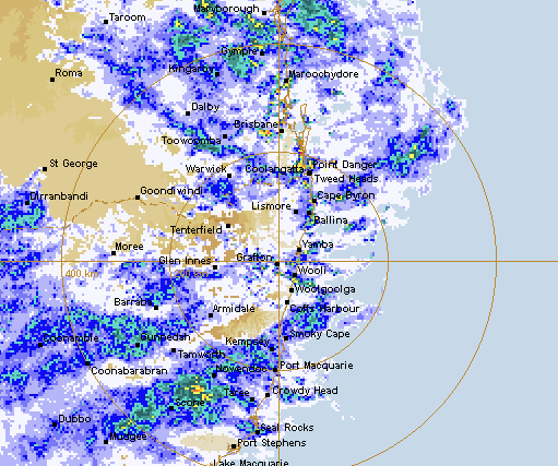
(The BOMs weather radar at 6pm)
The Bureau has also issued minor flood warnings for the following:
- Richmond River minor flooding
- Tweed and Rous Rivers minor flooding
- Brunswick River and Marshalls Creek minor flooding
- Clarence River minor flooding
- Orara River minor flooding
The most rainfall in the last 24 hours has fallen in the Wilsons River catchment to the east of Lismore, with Mullumbimby 119mm and Upper Crabbes Creek 120mm.
Further to the west, Nimbin has recorded 74mm, Terania Creek 62mm and Dunoon 95mm in the last 24 hours. Lismore Airport has recorded 13.8mm since 9am.
The NSW SES has a number of 'Stay Informed' notices across Lismore and the Northern Rivers as we approach Saturday, when the rain is expected to be at its most intense. For Lismore, 25-50mm is forecast.
These include:
- Lismore and surrounds
- Nimbin, The Channon and surrounds
- Coraki and surrounds
- Bungawalbin, Rappville and surrounds
- Casino and surrounds
- Kyogle and surrounds
- Wiangaree and surrounds
- Tabulam, Drake and surrounds
- Mullumbimby and surrounds
- Billinudgel and surrounds
- Murwillumbah and surrounds
- Chinderah and surrounds
- Tumbulgum and surrounds
- Grafton and surrounds
With forecast rainfall, the Wilsons River level may reach around 4.50 metres in Lismore overnight Friday into Saturday, with minor flooding. Further rises are possible.
Based on predictions from the Bureau of Meteorology, the following areas may be impacted by dangerous floodwaters:
- Low-lying roads, causeways and bridges
- Low-lying farming and rural areas
- Low-lying areas along the riverbanks
- Camping grounds along riverbanks and creeks
Lismore City Council has activated its Levee Action Plan.
As part of its standard flood response procedures, Lismore City Council crews have closed the lower levee gates ahead of the Wilsons River, reaching 4 metres.
Council says, "This endorsed action plan is well-rehearsed and forms the first stage of our flood protection system for the CBD. The initial six gates closed are at the Upper and Lower Hollingworth Creek and Gasworks Creek locations.
"Our Bridge Crew, is highly experienced in these operations. By day, they maintain our city’s bridges, but during flood events, they stand up as our levee responders. Each gate weighs around 130kg and requires a coordinated team effort to close. Every gate closure is carried out according to a detailed action plan that ensures safety and consistency.
"If the river rises, additional gates will be closed at key trigger points.
"This is the first step in a coordinated plan of activity. Please avoid parking in river-side carparks and stay informed through Council’s and other agencies official channels for the most up to date information."
The NSW SES advise what you need to do:
- If you have a Home or Business Emergency Plan, follow it. Otherwise, have a conversation and plan for what you will do and take with you if you need to evacuate.
- Consider the consequences of road and bridge closures and water over roads and make alternate arrangements for work, children, and travel.
- Obey all signs about road closures and instructions from emergency services.
- Never drive, walk, ride through, play or swim in floodwater - it is dangerous, toxic, and may void your car insurance. If it's flooded, forget it. Fines may apply.
- Avoid storm drains and pipes, ditches, ravines, creeks, and rivers.
- People in areas likely to be impacted by flooding should raise their assets, including waste and chemical containers above expected flood heights.
- Share this information with family, friends, and neighbours and help others prepare where possible.
- If you are likely to be isolated due to flooding, stock up on essential items now.
- People working or camping along the river should monitor river heights and be prepared to relocate to higher ground.
- Farmers should consider moving pumps and farm equipment to higher ground.
- Companion animals and livestock should be relocated to higher ground that will not become an island.
PROFESSIONAL
