What can we expect from the CSIRO report on June 30?

Simon Mumford
25 June 2025, 8:00 PM
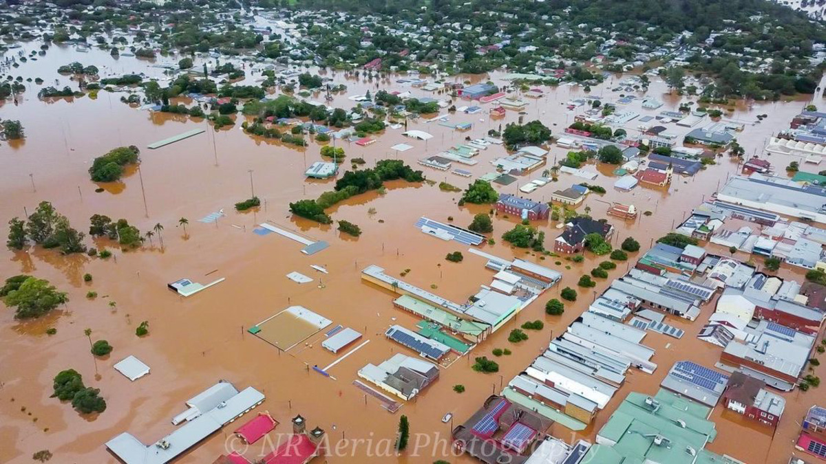 Lismore February 28 2022. Photo: NRs Areial Photography
The expectations from the release of the next phase of the $11.2 million Northern Rivers Resilience Initiative (NRRI), the first of its kind in the Northern Rivers, appear to be extremely high within the community.
Phase 1 was to map every square metre across the 7,000 square kilometre Richmond River catchment using LiDAR (Light Detection and Ranging) and river bathymetry technology to create a hydrodynamic model.
This model was delivered on time, as promised, by CSIRO lead scientist, Jai Vaze and his team on June 30 2024.
Phase 2 was to accurately replicate what happened in previous floods, including the 14.4-metre flood on February 28 2022, along with other major floods, like the second March 2022 flood, and the 2017 flood.
Phase 3 is what residents and the seven local council areas are really waiting for, the release of three to four mitigation scenarios, which include the combination of a number of interventions within each scenario. That will be released on June 30 2026.
History has proven that it is difficult to trust the state or federal government to deliver timely flood recovery and rebuild help following a disaster. There are always delays. However, Jai Vaze has delivered on every promise he has made, and he told the Lismore App that he will deliver the implementation model next Monday, June 30 2025.
How is the model implemented?
Jai has divided the 7,000 square metres Richmond River catchment area into 10.2 million triangular grids with no gaps, called a mesh. To get a visual representation, he said it is best to think of it as a spider web.
When Jai inputs the rainfall data from previous flood events, each event has to be replicated exactly as it happened at the time. His soon-to-be-released implementation model has been peer-reviewed by three independent experts: one from Japan, France and Australia.
The model can measure the velocity of water flow and depth from Nimbin to the Ballina outlet. The mesh is denser in areas that receive a lot of rainfall and coarser where it has never flooded.
What are the next steps?
Jai and his team will be in Lismore and the Northern Rivers in early July to hold meetings with the four councils inside the catchment, their technical staff and the community to get an understanding of what mitigation ideas should be included in the scenario model options.
The CSIRO team will return in early August for a second round of engagement.
More than likely, Jai will run three to four different modelling options, each with a number of different mitigation interventions, to determine the most effective flood mitigation results for the entire Richmond River Catchment.
It will take three months to get the mesh ready to run a scenario, and another two months to make adjustments to a mesh. And this is with a supercomputer that has 1 terabyte of RAM (random-access memory). To give this some perspective, the average computer will run 4 to 8 gigabytes, while some might run 16 for gaming. 1 terabyte is equal to 1,000 gigabytes.
June 30 2025, is an important date as it signifies that the CSIRO Richmond River Catchment Flood Model works like it should, giving certainty to the outcomes of the mitigation results to be delivered on June 30 2026. This is the critical date for residents and business owners who were affected by the 2022 big flood.
This is also the date that will cause anxiety for the Federal and NSW Governments. The release of the CSIRO's third report will need to be assessed, costed, and then a decision made as to how much will be invested in the Northern Rivers to help reduce the impact of future floods and potentially identify its long-term water supply.
Early hypothetical estimates from a range of people, including local politicians, is that $2 billion will be the minimum cost.

