Tropical Cyclone Alfred update: expected to turn towards coast Tuesday

Simon Mumford
02 March 2025, 3:00 AM
 Issued at 11:53 am AEDT Sunday 2 March 2025 by the Bureau of Meteorology
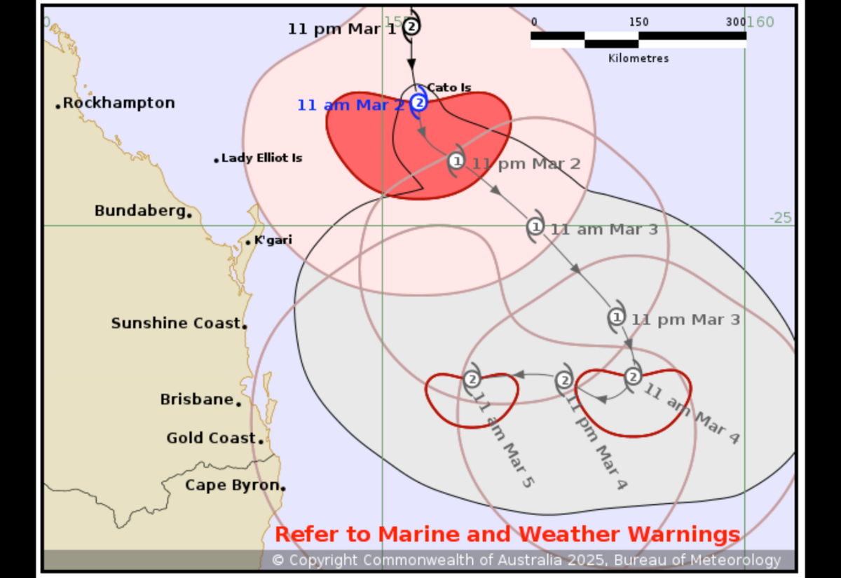
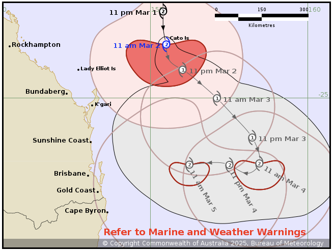
Tropical Cyclone Alfred is taking the path forecast by the Bureau of Meteorology as it moves south parallel to the Queensland coast and away from the coastline.
At 11am this morning, Alfred was a Category 2 system 515 kilometres east of Rockhampton and 370 kilometres northeast of Bundaberg moving at 10 kilometres per hour.
Alfred has been weakening as it heads south and tonight it is forecast to turn southeast and move further away from the Queensland coast while weakening a little further.
Unfortunately, Alfred is then expected to slow down and is likely to turn westward from Tuesday, moving back towards the southern Queensland coast. The forecast path shown above is the Bureau's best estimate of the cyclone's future movement and intensity. There is always some uncertainty associated with tropical cyclone forecasting and the grey zone indicates the range of likely tracks of the cyclone centre.
There is hope that the system may take a different path on Tuesday.
As you would expect at this early stage of Alfred's path, the rainfall range from The Bureau is wide.
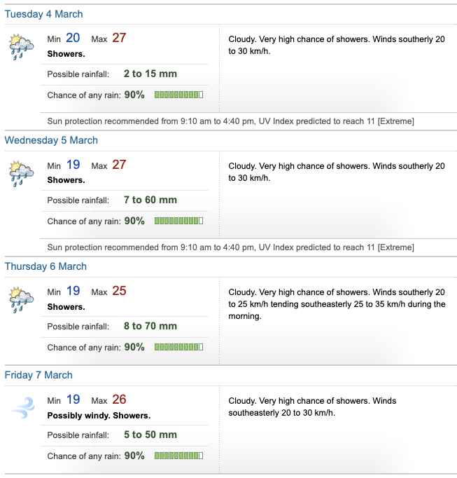
The best case scenario at the moment is for 22mm over the four days (Tuesday to Friday), while the worst case scenario is 195mm over the four days.
You can keep up to date with Cyclone Alfred through the Lismore App Weather or through this Lismore App website link https://reg.bom.gov.au/nsw/forecasts/lismore.shtml.
(Issued at 11:53 am AEDT Sunday 2 March 2025 by the Bureau of Meteorology. No Tropical Cyclone Advice is current for this system.)