More thunderstorms expected this afternoon: What to expect and how to prepare
Lara Leahy
14 November 2024, 1:55 AM
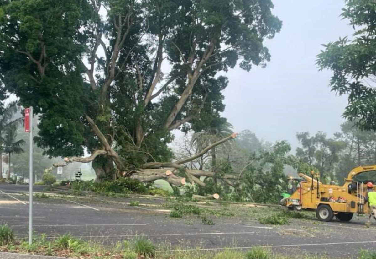
 One of the beautiful big trees at Lismore Golf Club was severely damaged in the storm last night. Photo: Steve Mackney
The storms this week have kept the SES and Essential Energy decidedly busy. Last night's storm centred over Federal with pockets of blackouts, damage all over and reports of 4cm hail in Goonellabah and 4-5cm in Bangalow.
The Bureau of Meteorology is forecasting further thunderstorms tonight, possibly severe, with some recommendations from the SES if you have time to prepare. The worst of tonight's thunderstorm activity will be in South East Queensland and the border ranges of Northern NSW, so Murwullimbah way.
Scott McLennan, the Incident Controller from the SES told the Lismore App, “The storms have been hectic, ferocious and quite intense in some locations. During the week, the whole zone has had approximately 140 jobs, and 70 of those came through last night.”
Main Arm Public School was damaged in last night's storm, and there were a few areas around Lismore with trees down.
The winds that accompanied these storms were strong - at Lismore Airport around 4pm, the wind was blowing at over 50km/h and gusting up to 85 km/h. Strong winds are expected to be with us for the days to come.
Scott warns that more severe storms, including damaging winds, are expected between 1pm and 9pm this afternoon. “Power outages are one of those things expected once more, so consider what they will do should the power go out.”
The worst is expected at the border, around Tumbulgum.

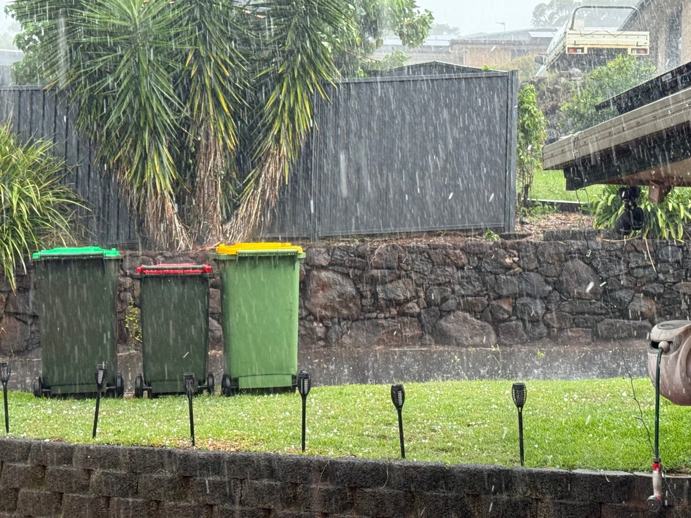
(Hail falling in Goonellabah yesterday where 4cm size hail was recorded)
In these storms, “There could be some hail, but the issue is going to be damaging winds because everything is so wet at the moment, and there's been a lot of wind from yesterday.
“A lot of people's gutters and drains are all now blocked with leaves and debris. So it's an opportunity, while the sun is shining, to quickly clear your gutters, clear your drains, and expect another storm today.”
The weather pattern will continue over the weekend.
“Tomorrow, there should be just some isolated showers, but we're looking at more storms coming in on Sunday. Ahead of that, there's going to be some significant winds on Saturday and Sunday.”
Dangers include unsecured items being blown around and battered trees and branches getting “tired” and coming down.
Scott reminds people, “If it’s flooded, forget it.
“There was one incident where someone did drive into a puddle of water and stalled, so they called in as a flood rescue, but they could actually walk out.
“It happened in one of those storm drains. People love driving through a big puddle of water to create a big splash. It’s fun; however, in small cars, what generally happens is they stall and get stuck, and then they panic.
“Don't try and plough through those puddles or flooded storm drains or causeways or culverts. You don't know what's underneath. There could be a big tree branch, or it could be something underneath that could flick up and damage your car, or it could be deeper than what you think it is.”
The SES will be at the Resilient Lismore meeting tonight at South Lismore Bowling Club at 6pm.
The Lismore App will notify its readers of any thunderstorm warning as soon as it is published by the Bureau of Meteorology.

