Lismore Airport rain gauge fixed as residents question totals
Simon Mumford
16 January 2024, 5:02 AM
 Weather radar at 4pm today (Tuesday)
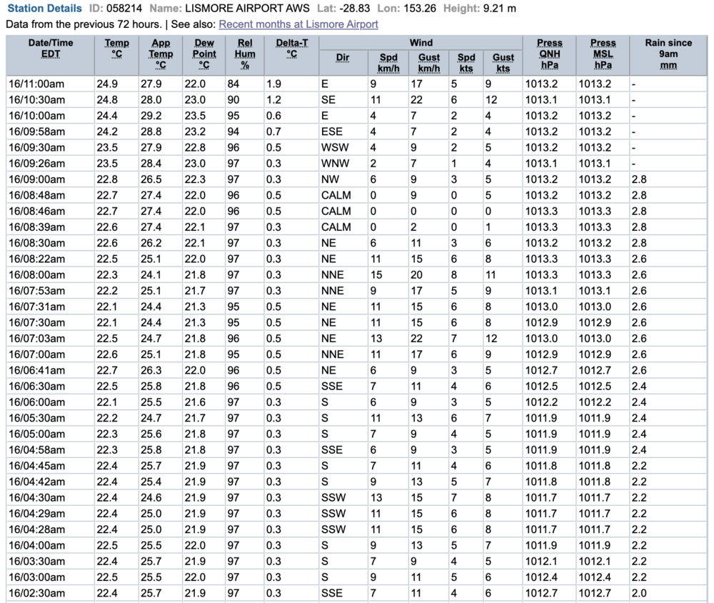
If you were looking for Lismore rainfall totals via the Bureau of Meteorology's 'Lismore last 24 hour' website page, you would have noticed some very low totals.
To 9 o'clock this morning, the site indicated that Lismore had 2.8mm which given the rain we have had in the last 24 hours didn't match people's personal rain gauges.

A Lismore App first contacted us saying they had recorded 165mm at their home in the CBD and this morning the Lismore Golf Course was closed for the day.
After an inquiry to The Bureau, a spokesperson said, "The Bureau of Meteorology is aware that the Lismore Airport 24 hour rainfall to 9am this morning appears to be incorrect. The Bureau is currently investigating. Please see here for other nearby rainfall data: http://www.bom.gov.au/nsw/flood/northcoast.shtml.
The Bureau has since been in contact saying the Lismore Airport rain gauge is no fixed.
The more detailed page tells us that Lismore had 68mm in the last 24 hours at the Dawson Street gauge.
The heaviest rainfall was on the coast with Ballina recording 152mm, seeing flash flooding along River Street, while Byron Bay received 142mm and further South parts of Coffs Harbour experienced falls between 112 and 174mm which led to a flood warning.
There were lighter falls in the catchments of the Northern Rivers with Nimbin receiving 34mm, The Channon 34mm and Goolmangar 32mm. On the Wilsons River side, Nashua received 55mm.
Unfortunately, the chance of more heavy rain and thunderstorms, due to a very humid air mass drawing down from the tropics which is combining with a cold front, is possible this afternoon and evening.
Morgan from The Bureau said it is still important to keep an eye on the warnings today and tomorrow.
"Looking at tomorrow, it does seem that there's that chance of some thunderstorms, not so much along the coast of the northern rivers, but for Lismore, down to Grafton and for Tenterfield to see some activity."
"Otherwise, while the area at the moment for tomorrow (Wednesday) is outside of the severe possible region, I want to encourage people to still keep an eye on the forecast, even possibly the radar as well as the warnings, just in case that area does change into tomorrow."
"But otherwise, with today we do still have the chance of 9 to 30 millimetres on the forecast at Lismore for any possible showers."
"For tomorrow, for Lismore, we've got that 0 to 5 millimetres possible with any showers."
Morgan explained the heavier falls would be associated with thunderstorms but only if they formed otherwise we may just see further showers.
"These are not expected to be as high as what we have seen in the past 24 to 48 hours. At the moment, with the forecast that we have, it's expected to ease but there's still the chance of some thunderstorm activity for Thursday and Friday, but again, not expecting it to be as significant as the rainfall that we've seen in the 24 hours to 9 a.m. this morning."
As for a bit of blue sky?
"Even tomorrow, we could have some areas of sunny conditions and clearer skies at times, but otherwise still a partly cloudy day expected," Morgan explained, "And we could still see some areas of sunshine over Thursday and Friday. We're not going to see a day without the chance of showers or a day with mostly sunny or sunny conditions on the forecast for Lismore and around the Northeast."
"At the moment it's that medium to high and even very high chance of showers. I'm sure people will enjoy the sun when it does come out, but otherwise, keep an eye on the radar and the warnings as well as we head throughout this afternoon and the next seven days."
You can keep an eye on the weather warnings and the weather radar from The Bureau on the Lismore App Weather & Travel.

