UPDATED list of Lismore's flooded road closures
Liina Flynn
15 December 2020, 9:34 PM
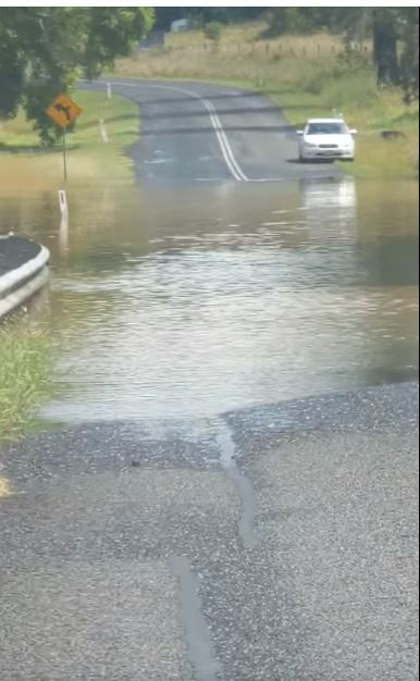
 Boatharbour Road is still flooded today.
A number of roads in the Lismore City Council area are currently closed due to flooding, so take care on the roads and make alternative plans if you need to travel to affected areas.
Wilsons River peaks with minor flooding and weather warning lifts
The following list of closed roads is accurate as of this morning:
Boatharbour Road, between McKinnon Road and Cameron Road
Boatharbour Road, between Richmond Hill Road and McKinnon Road
Hensley Carpark (Lower Level - Free Parking)
Molesworth Street, Between Zadoc and Orion Streets, Lismore
Pitt Street, North Lismore
Rowing Club Car Park (Paid Area)
Simes Bridge, North Lismore
Town Bridge, Town Road (off Terania Creek Road) The Channon
Woodlawn Road
Wyrallah Road (RR742)
Exercise caution on the following roads:
Bice Road
Boyle Road, Goolmangar
Corndale Road
Jiggi Road
Keerong Bridge Road, Keerong
Keerrong Road
Nimbin Road
Terania Creek Road, Terania Creek
Tuntable Creek Road

This picture shows the flooding over the road on Nimbin road, on the Lismore side of Goolmangar School at approximately 12pm yesterday.
The NSW SES advises people not to walk or drive through floodwaters as this is the main cause of death and injury during flooding.
If you need to evacuate from where you are due to flooding, the SES also advises you to
- Raise belongings by placing them on tables, beds and benches.
- Put electrical items on top. You may be able to place some light-weight items in the roof space.
- Collect together essential medicines, important documents, mementos and photos to take these with you.
- Make arrangements for care of pets or other animals or take pets with you to an evacuation centre.
- Turn off the electricity and gas.
- Take three days’ supply of clothes with you.
- Continue to listen to a local radio station for updates.
For emergency help in floods and storms, call the NSW SES on 132 500. In life threatening situations call triple zero (000) immediately.
For more information:
• Radio: Listen to ABC North Coast radio 94.5FM and your local radio station
• Lismore Council Disaster Dashboard: Go to https://disaster.lismore.nsw.gov.au/
• Social Media: Follow NSW SES Northern Rivers and NSW SES Lismore City Unit on Facebook or monitor NSW SES website - www.ses.nsw.gov.au
• Latest Weather, Warnings, Rainfall and River heights: Go to both www.bom.gov.au/nsw/ and www.bom.gov.au/qld/
• Road Closures: Go to www.livetraffic.com.au or www.myroadinfo.com.au
- • Rural animal and livestock assistance: Contact Local Land Services


