Severe weather brings brown skies to Lismore
Liina Flynn
07 November 2019, 5:46 AM
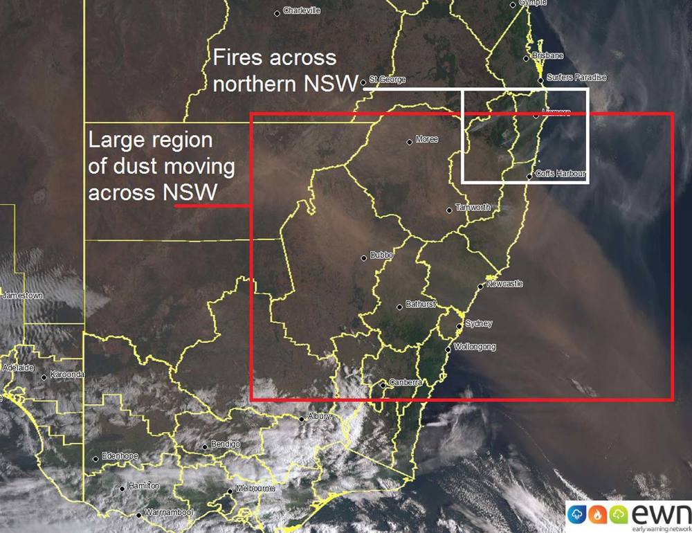
 EWN satellite and lightning tracker and show the dust plumes moving across the State.
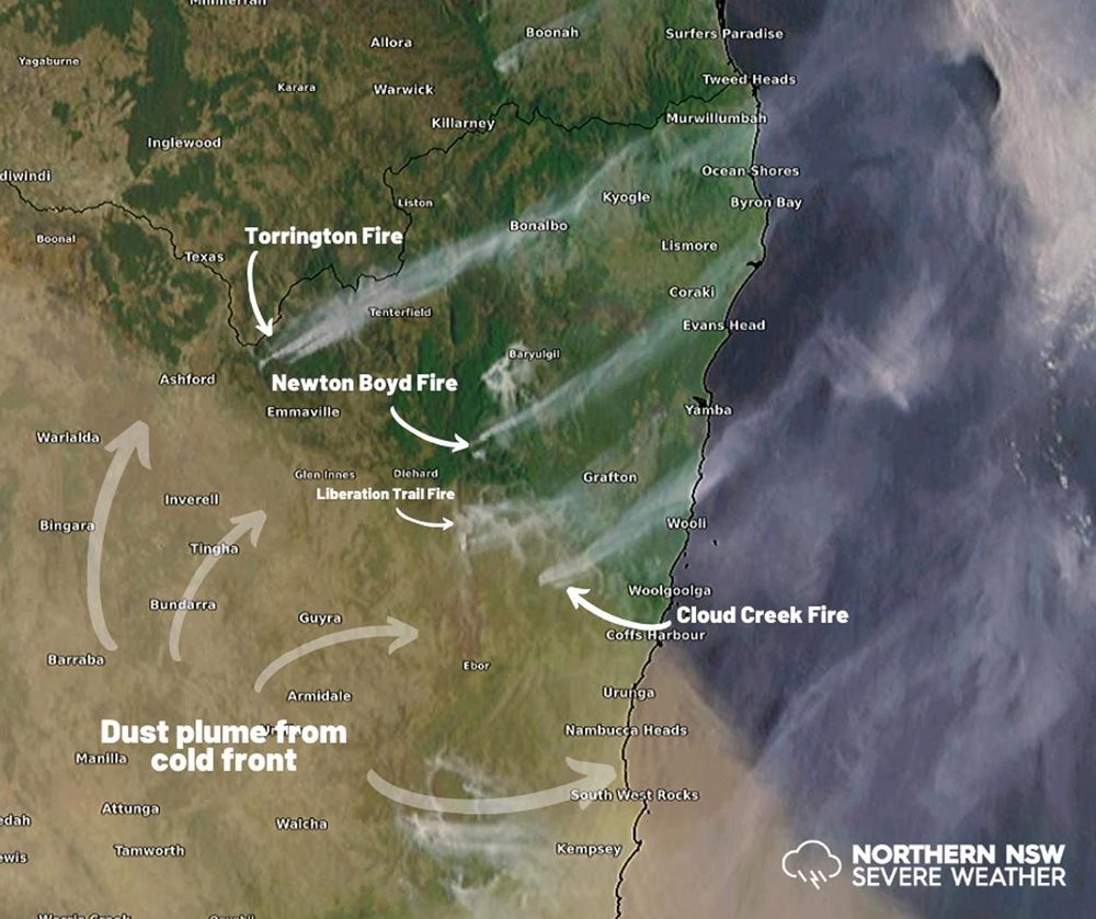
Brown skies in Lismore and poor visibility today in the region is a result of an incoming dust plume, along with major fires burning in the far northeast corner of NSW.
Northern NSW Severe Weather has reported that the large plume of dust has been kicked up by strong winds associated with a vigorous cold front and weather trough moving across the country.
Severe fire dangers are now in place across the Far North Coast, North Coast, New England, Greater Hunter and Northern Slopes.
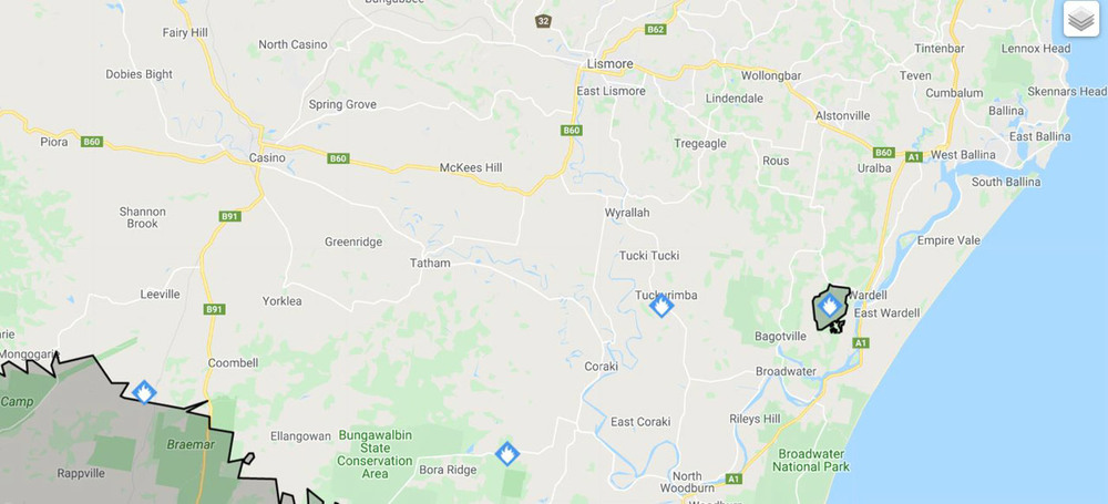
The Rural Fire Service has reported a bush fire burning at Wardell Road at Wardell; grass fires burning at Myall Creek Road at Bora Ridge and at Wyrallah Road at Tuckarimba; and a pine needle fire at Carwon State Forest in Richmond Valley. There is also a fire burning near Tenterfield.
All state forests from Sydney to the Queensland border are closed for the next three days due to increased fire risks. Read more: All State forests to the border closed from today
The following image from Northern NSW Severe Weather is taken from EWN satellite and lightning tracker and show the dust plumes moving across the State:

Northern NSW Severe Weather have created a graphic showing dust plumes from fires, which are causing poor visibility:

The Rural Fire Service's Fires Near Me map shows fires burning near Lismore:

