High Tech Hub to strengthen NSW Govt emergency response
05 October 2024, 9:00 PM
A high-tech geo-mapping tool and emergency hub is being used to assist NSW Government responses to emergencies like bush fires, floods, earthquakes, utility failures, cyber-attacks, and major incidents.
As many locals remember from February 28, 2022, the NSW Government's response was ad hoc, with poor outcomes for residents in Lismore and the Northern Rivers.
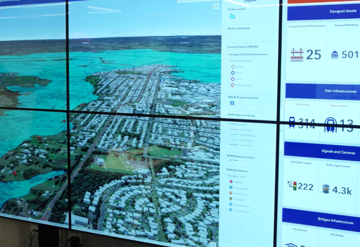
Developed by Transport for NSW, the geospatial tool layers around 200 live and 300 static data sources onto a map to generate a comprehensive, visual decision-making aid. It provides Transport and response agencies with an instant snapshot of the scale of an incident in real time.
The TransportOne dashboard can zoom into a location and identify the number of transport assets like traffic lights, bridges, train stations and roads impacted by a disaster or disruption, as well as other government assets such as utility hubs, schools or hospitals. The tool can also identify the real-time location of crews, including Maritime vessels.
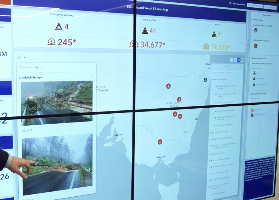
It then goes a step further, helping to predict and plan for future impacts on transport infrastructure by modelling the forecasts and warnings of partner agencies such as the Bureau of Meteorology, Rural Fire Service (RFS), and State Emergency Service (SES) onto the map.
The dashboard covers the whole state and can be instantly shared with internal Transport teams and combat agencies, including the RFS, NSW Police, and State Emergency Service.
Having a comprehensive, shared, real-time understanding of emergencies helps Transport for NSW resources be positioned where they are needed most in a crisis. It also informs decisions about when and where to open support services and determines how to re-establish transport links quicker.
Transport for NSW Secretary Josh Murray said, “We manage more than 28,000 public transport stops, train stations, wharves, and bridges, and around 21,000km of roads across New South Wales. Understanding which of these are impacted by an emergency or disruption helps us quickly access alternate transport options around the area and later re-establish crucial links faster.
“The mapping tool can use Bureau of Meteorology forecasts, information from the RFS, SES, plus Transport data to predict the potential impact of extreme weather systems before they hit.
“It's a fantastic use of innovation to help keep our people safe, our communities connected, and our supply chains open during emergency situations.”
NSW Rural Fire Service Deputy Commissioner Peter McKechnie said, “Bush fire season is officially underway in NSW and following a number of very wet years, there is a real risk of bush and grass fires across the state.
“As the RFS and its partner agencies undertake their preparations, it’s important families and landowners take the time to prepare as well.”
NSW Maritime Executive Director Mark Hutchings said, “The tool has been a game changer when we’ve been out supporting the State Emergency Service during their flood responses, and as part of our day-to-day management of waterways across the state.
“Before an event we can identify navigation aids and other Maritime infrastructure that are likely to be impacted before flooding occurs to help waterways recover faster. During an event it helps us see critical, up to date information including road closures, weather warnings and impacted assets instantly with a single search.
“During the Hawkesbury floods earlier this year we used the forecast rain and flooding information to help plan our operations. Teams on the ground and in our State Marine Incident Coordination Centre used Transport One for visibility on the locations of each crew in the context of what was happening in the flood zone.

