Floodplain Mitigation: not much has changed in 30 years
Simon Mumford
20 April 2022, 6:32 AM

As the second major flood of 11.4 metres was subsiding, the Lismore App was contacted by people with some knowledge of flood mitigation dating back to the 1990s.
A number of Lismore Echo articles were submitted to read and look at the history of Flood Mitigation options for the last 30 odd years.
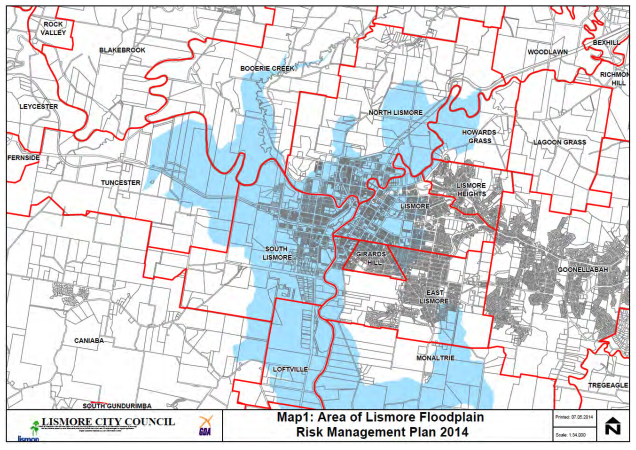
What stood out the most was that very little has changed in that time apart from the building of the CBD levee wall in 2005 and the South Lismore Flood Mitigation works in 2019.
The debate continues about the best option to protect the CBD with minimal impact on North and South Lismore.
Flood Mitigation funding has always come into play which was another reason no 'whole of catchment' solution has been implemented. In the 1990s local councils were supposed to pay 20% towards the cost of any solution which meant a rate increase, never a popular option. Lismore City Council hasn't been able to afford even a 1% contribution for the last decade so that option can be excluded. The term "benefit-cost ratio" was used a great deal. After a 14.4-metre flood and billions of dollars worth of damage, those ratios surely must have changed in 2022.
Then there is the ongoing political debate between the conservatives and the greens, engineering solutions versus nature-based solutions. Of course, this view is at either political end of the stick with many in the middle supporting a combination of those options if it was the best option for Lismore and the Northern Rivers. What benefits us cannot have a negative impact on Coraki or Woodburn.
Warning! This part of the news story will not please everyone, they are a number of Flood Mitigation theories that were first raised after the 11.28-metre flood of 1989 and are still being talked about today.
- LEVEE WALL RAISED TO 11.5 metres: There were three levee proposals in 1992. Option A was 12.5 metres so 230mm above the 1974 height (one in 100-year flood), Option B 11.5 metres (one in 20-year flood) and Option C was 'do nothing'. In an LCC survey in 1992 where 251 residents responded via letter, 66% favoured Option A, 25% Option B and 8% Option C, however, a public meeting of 300 residents strongly favoured Option B with 'do nothing' supported and few supporting Option A. Option B, the 11.5-metre levee wall was voted as the preferred option. This vote changed in 1995 when the existing 10.5-metre levee wall (one in 10-year flood) option was adopted. The South Lismore levee wall (earthworks) was first built in the 1970s at 10.5 metres so the CBD levee was built to the same height.
- ENLARGING THE CHANNEL BY DREDGING: increasing the area where floodwaters are spread across the flood plain. Seen as ineffective.
- CHANNEL DIVERSIONS: This option would involve building a channel that starts further up Leycester Creek to divert some of the floodwaters away from the CBD. The proposed channel moves floodwater between the Lismore Airport and Caniaba then rejoins the Wilsons River south of the airport. This would need to be part one of a larger 'whole of catchment' project because it does not help Coraki and Woodburn. The added option is to build a new channel cut into the ocean near Woodburn to increase the flow of water into the ocean so there would be two options for the water to flow out to sea via Ballina (as is the only case now) and via a new channel near Woodburn.
- UPSTREAM RETENTION BASINS: creating a number of retention basins that hold back the flow of water down the river system. This can cause longer minor flooding behind the retention basins.
- REAFFORRESTATION: provides small benefits for flood mitigation but provides other benefits such as reducing erosion, improving water quality and providing wildlife corridors.
While the above offer broad theories for Flood Mitigation our sources have said that the science would dictate the best place for the best level using hydrologic studies to achieve the best outcomes.
It has been said that some of the above options would mean some current housing would be lost through a buy-back scheme and maybe some businesses.

When you look at Lismore's Flood Mitigation history the Floodplain Management Committee has put forward countless proposals but nothing has been implemented on a large scale apart from the levee wall and the small South Lismore project for $8.2 million. There have been a lot of talks, and a lot of committee meetings with a Floodplain Management Plan but where are the results driven by Lismore City Council for meaningful work in the last 30 years? Funding was a definite roadblock but surely that excuse cannot be used following a 14.4-metre flood with a damage bill in the billions.
If you increase the levee wall to 11.5 metres what impact will this have on South and North Lismore? Our sources say very little on South Lismore with 90mm increase in North Lismore. This is another reason that nothing gets done, there are so many existing residential and commercial pieces that council needs to satisfy which is impossible. You cannot make everyone happy when leading the way for reform.
Yesterday, the Premier announced the formation of the Northern Rivers Reconstruction Corporation saying the body will "ensure that we build infrastructure and homes that ensure communities across the Northern Rivers are in a much stronger position, not just for the homeowner but for their children and their grandchildren".
Can we not treat Flood Mitigation the same way? It is surely better than doing nothing and waiting for the next major flood to hit to go through the cycle of rescue, recovery and rebuild yet again.


