Flood gates close, schools close, river still rising
Liina Flynn
14 February 2020, 12:00 AM
 The flood gates are now closed.
10am: Lismore City Council has closed the lower Hollingsworth, upper Hensley and the Gasworks flood gates and the pumps have been checked and are on standby. Many local roads are also closed due to flooding.
The NSW SES is predicting the Wilsons River at Lismore (AHD) is likely to peak near 8.00 metres around midday today, with a moderate level of flooding.
Local schools have also reported closures for today, including Richmond River High Campus and Trinity Catholic College - which has been closely monitoring the flood waters as they encroach on the school site overnight. St Johns College at Woodlawn also evacuated all students yesterday.
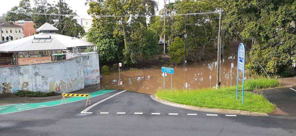
The Rowing Club carpark Friday morning 9.30am.

The widespread rainfall across the Wilsons River catchment area over the last few days means the river is still rising, so where it stops is still unpredictable.
The Bureau of Meteorology have also predicted a 60% chance of rain showers today, with a chance of a thunderstorm during the morning and afternoon.
The NSW SES have reissued a minor to moderate flood warning for the Richmond River and Wilsons Rivers, also reporting that there is minor flooding in Kyogle, Coraki and Bungawalbyn.
Road closures (at 8am)
A number of local roads are closed, including:
Bangalow Road, Boatharbour Road, Alexandra Parade North Lismore, Bridge Street North Lismore, Brunswick Street, Corndale Road, Hensley Carpark (Lower Level - Free Parking), Jacobson Road Causeway, Georgica, Keerong Rd (Bowens Bridge), Mackie Road Causeway Johnston Creek Rosebank, Mackie Road Ridgewood Bridge Clunes, Molesworth Street between Zadoc and Orion Streets Lismore, Nimbin Road Booerie Creek Bridge, Pitt Street North Lismore, Rowing Club Car Park (Paid Area), Simes Bridge North Lismore, Town Bridge Side Track Town Road (off Terania Creek Road) The Channon, Town Bridge The Channon, Tweed Street North Lismore, Winterton Parade North Lismore, Woodlawn Road, Wyrallah Road (RR742), Bentley Road Tullera, Boggumbill Road Rock Valley, Brewster Street near the Square, Caniaba Road, Dawson Street at Zadoc Street Intersection, Dunoon Road, Flood Reserve Road Ruthven, James Gibson Road Clunes, Kyogle Road, Lindendale Road.
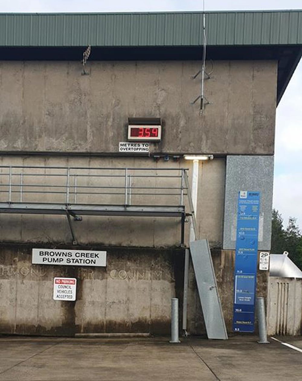
Pump Station countdown 7.30am.
Latest river heights this morning at 6.30am
Leycester Creek at Rock Valley 7.00 Falling 06:32 AM FRI 14/02/20
Terania Creek at The Channon 3.12 Steady 06:30 AM FRI 14/02/20
Coopers Creek at Ewing Bridge Corndale 7.98 Steady 06:28 AM FRI 14/02/20
Wilsons River at Eltham 8.82 Steady 06:30 AM FRI 14/02/20
Wilsons River at Woodlawn (AHD) 7.86 Rising 06:28 AM FRI 14/02/20
Leycester Creek at Tuncester (AHD) 8.43 Falling 06:28 AM FRI 14/02/20
Wilsons River at Lismore (AHD) 7.14 Steady 06:08 AM FRI 14/02/20
Richmond River at Wiangaree 8.00 Falling 06:00 AM FRI 14/02/20
Richmond River at Kyogle 13.25 Rising 06:00 AM FRI 14/02/20
Richmond River at Casino (Automatic Gauge) 9.49 Rising 06:00 AM FRI 14/02/20
Richmond River at Coraki 3.95 Rising 06:15 AM FRI 14/02/20
For more information:
River Heights: http://www.bom.gov.au/nsw/flood/rain_river.shtml
Warnings: http://www.bom.gov.au/nsw/warnings/
NSW SES Floods: https://www.ses.nsw.gov.au/disaster-tabs-header/flood/
• Listen to your local ABC radio station, follow /NSWSES on Facebook or www.ses.nsw.gov.au
• Latest Weather, Warnings, Rainfall and River heights: www.bom.gov.au/nsw/
• Road Closures: www.livetraffic.com.au or www.myroadinfo.com.au
• Rural animal and livestock assistance, contact Local Land Services

