Cyclone Alfred tracking away from the coast over the weekend

Simon Mumford
27 February 2025, 4:02 AM
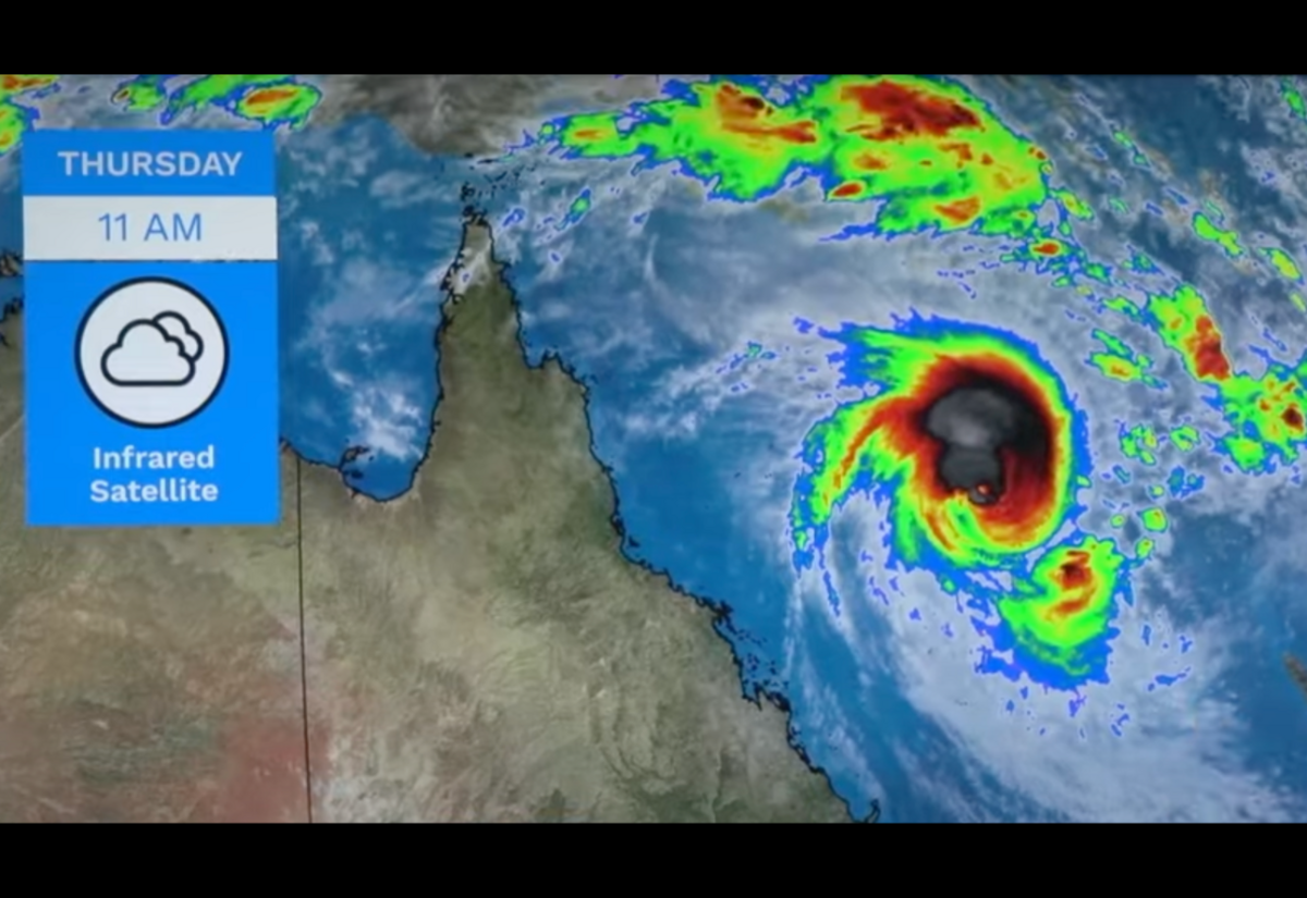 Cyclone Alfred 12 midday NSW time. Photo: Bureau of Meteorology
Tropical Cyclone Alfred has many people in Lismore and the Northern Rivers worried as it heads south in the Coral Sea parallel to the Queensland coast but out to sea.
Alfred's path was uncertain, and there was certainly speculation over its effect on the Northern Rivers, given February and March are our most prolific rainfall months.
As of today, Lismore has received only 128.6mm at the Lismore Airport, which is more than last year's 115.8mm but lower than the mean of 142.5mm.
March's mean is 181.4mm, so we can expect a wetter month.
Angus Hines from the Bureau of Meteorology said they are starting to get more confidence and more certainty about Alfred's likely path.
As of 12 midday NSW time, Angus said the signs show a strengthening system, so Cyclone Alfred is likely to increase from a Category 3 to a Category 4 over the weekend.
"There are a couple of changes to this track compared to the tracks from yesterday, and that's the first one there, the Category 4 symbol that we see on Friday afternoon, as we expect Alfred to intensify during Friday even further.
"However, as Alfred continues to move southwards, it's likely to move into an area of slightly cooler ocean temperatures down here, which means the intensification will probably stop, and potentially it will even go back to a Category 3 tropical cyclone by Saturday morning.
It is at this point that Alfred is expected to move towards the Queensland coast, but not reaching the coast, as a Category 3.
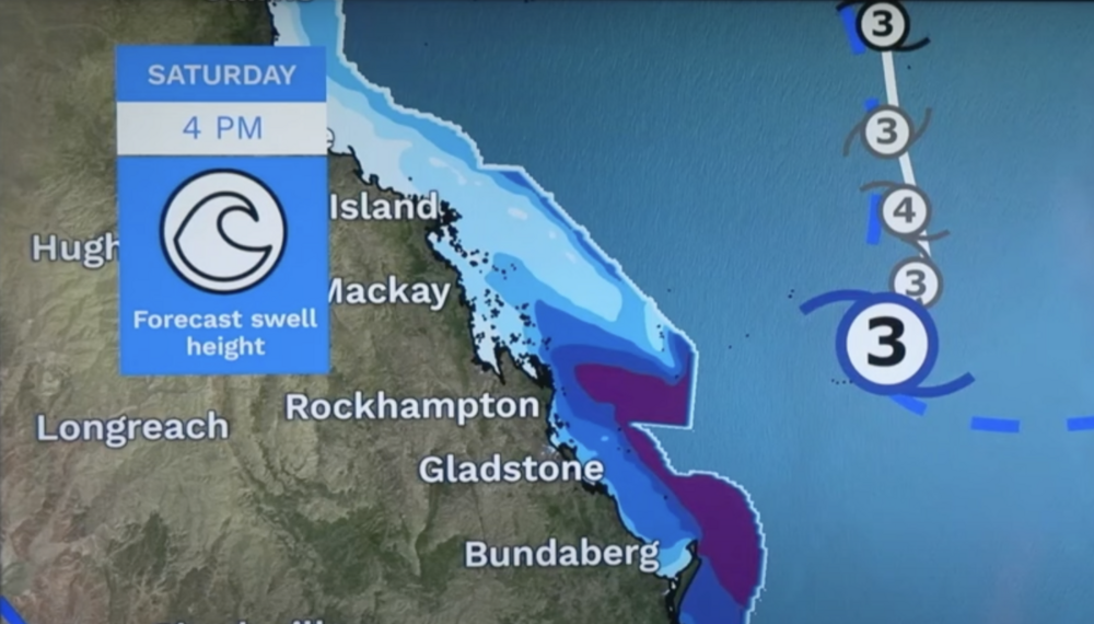
"This is going to mean an increase in wind and swell across eastern parts of Queensland. We've got a number of marine wind warnings already in place from Townsville down to K'gari, and these warnings could well be extended down to the southeast in the next day or two as well. And really, one of the most significant impacts of this turn towards the coast is going to be an increase in the swell."
Importantly for the NSW Far North Coast, the second movement on Sunday should see Alfred moving away from the coast, which is likely to see it classified down to a Category 2 on Sunday or Monday and start a southeastward trajectory. This would mean less influence on our weather; however, it may linger over the Tasman Sea.
"This doesn't mean we're quite out of the woods yet. there is a chance that tropical cyclone Alfred could just hang out over the Tasman Sea for a few days in a row, and then may get blown back towards the country if an easterly wind picks up. However, if that occurs, it's likely that tropical cyclone Alfred would be a category one, or potentially a tropical low, no longer being tropical cyclone status.
"So, there's still a lot to go with the system. It's got a long life ahead of it, hopefully staying away from the country."
The Bureau is forecasting a potentially wet Monday to Thursday at this early stage, but nothing significant.